Bennett Dome
| Bennett Dome | ||
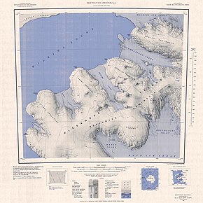
 Topographic map of the Beethoven Peninsula (1: 250,000) with the Bennett Dome (bottom right) |
||
| Geographical location | ||
|
|
||
| Coordinates | 71 ° 48 ′ S , 73 ° 3 ′ W | |
| location | Alexander I Island , West Antarctica | |
| coast | Beethoven Peninsula | |
| Waters | Weber Inlet | |
| Waters 2 | Boccherini Inlet | |
The Bennett Dome is an ice dome- like peninsula with a height of 460 m on the West Antarctic Alexander I Island . It is located on the south side of the Beethoven Peninsula and separates the Weber Inlet from the Boccherini Inlet .
The British geographer Derek Searle from the Falkland Islands Dependencies Survey mapped them in 1960 using aerial photographs taken by the American Ronne Antarctic Research Expedition (1947–1948). The United States Geological Survey used aerial photographs of the United States Navy from 1967 to 1968 and Landsat photographs from 1972 to 1973 to determine the location more precisely . The Advisory Committee on Antarctic Names named the peninsula after Joseph E. Bennett, who headed the Polar Coordination and Information Section for the National Science Foundation's Polar Program from 1976 to 1986.
Web links
- Bennett Dome in the Geographic Names Information System of the United States Geological Survey (English)
- Bennett Dome on geographic.org (English)
