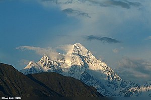
Bilchhar Dobani
| Bilchhar Dobani | ||
|---|---|---|
|
Bilchhar Dobani from Jutial (near Gilgit) |
||
| height | 6143 m | |
| location | Gilgit-Baltistan ( Pakistan ) | |
| Mountains | Rakaposhi Haramosh Mountains ( Karakoram ) | |
| Dominance | 15.22 km → Miar Chhish | |
| Notch height | 1601 m ↓ ( 4542 m ) | |
| Coordinates | 35 ° 57 '20 " N , 74 ° 38' 3" E | |
|
|
||
| First ascent | June 9, 1979 by Isao Ikeuchi and Masaru Hashimoto | |
|
Bilchhar Dobani (right) and the somewhat further away Rakaposhi (7788 m, left) from the south over the Indus valley. |
||
The Bilchhar Dobani (or short Dobani ) is a mountain in the western Karakoram in Pakistan's special territory Gilgit-Baltistan .
location
The Bilchhar Dobani is located in the southwest of the Rakaposhi Haramosh Mountains , about 18 km south of the Diran . The mountain has a height of 6143 m (according to other sources 6134 m ) and rises 29 km east of the city of Gilgit . The Gutumi Glacier has its nutrient area on the north side of the Bilchhar Dobani. The Bagrot Valley runs along the western flank of the Bilchhar Dobani.
Ascent history
The Bilchhar Dobani was first climbed on June 9, 1979 by the two Japanese Isao Ikeuchi and Masaru Hashimoto over the west face and the north ridge.
Web links
- Bilchhar Dobani on Peakbagger.com (English)
- Bilchhar Dobani at panoramio.com (photo)
- Bilchhar Dobani at flickr.com (photo)
- himalaya-info.org
Individual evidence
- ^ Masaru Hashimoto: Asia, Pakistan — Karakoram, Dobani . American Alpine Journal, 1980, vol. 22nd


