Billesweiher
| Billesweiher | ||
|---|---|---|

|
||
| The Billesweiher | ||
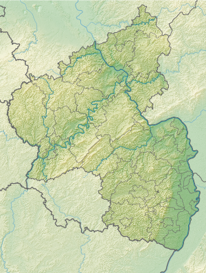
| Geographical location | Local community Enkenbach-Alsenborn , Kaiserslautern district , Rhineland-Palatinate , Germany | |
| Tributaries | Billesbach | |
| Drain | Billesbach | |
| Data | ||
| Coordinates | 49 ° 30 '45 " N , 7 ° 56' 13" E | |
|
|
||
| Altitude above sea level | 294.7 m above sea level NN | |
| length | 360 m | |
| width | 75 m | |
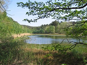
The Billesweiher is a still water in the municipality of Enkenbach-Alsenborn in the district of Kaiserslautern in Rhineland-Palatinate .
The natural monument with the number ND-7335-177, which is flowed through and fed by the Billesbach , is to the east of the residential area Randeckerhof (community Neuhemsbach ) and directly on the western state road L 394. The pond is about 360 meters long and a maximum of about 75 meters wide.
Characteristics
At the Billesweiher there is a circular path suitable for wheelchair users with a length of approx. 1 km. The Billesweiher is surrounded by a species-poor mixed forest of beech and grove . The water surface is bordered by a more or less pronounced silting zone. Two amphibious tunnels have been built through the dam. Both the reed belt in the north, the alder fragments in the east and the silting zone in the inlet area are breeding and feeding areas for various bird species and spawning areas for amphibians. The Billesweiher is not a bathing or fishing water, but is freely accessible all year round.
Web links
- Billesweiher in Enkenbach-Alsenborn on enkenbach-alsenborn.de
Individual evidence
- ↑ Entry in the Rhineland-Palatinate Landscape Information System ( memento of the original from March 5, 2016 in the Internet Archive ) Info: The archive link was inserted automatically and has not yet been checked. Please check the original and archive link according to the instructions and then remove this notice.
