Bloomingdale (Ohio)
| Bloomingdale | |
|---|---|
|
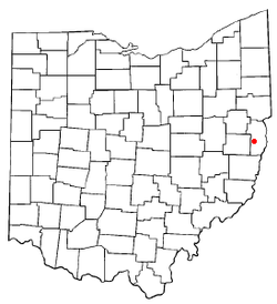
Map of Ohio, Bloomingdale highlighted
|
|
| Basic data | |
| Foundation : | 1816 |
| State : | United States |
| State : | Ohio |
| County : | Jefferson County |
| Coordinates : | 40 ° 21 ′ N , 80 ° 49 ′ W |
| Time zone : | Eastern ( UTC − 5 / −4 ) |
| Residents : | 202 (as of 2010) |
| Population density : | 878.3 inhabitants per km 2 |
| Area : | 0.23 km 2 (approx. 0 mi 2 ) of which 0.23 km 2 (approx. 0 mi 2 ) is land |
| Height : | 385 m |
| Postal code : | 43910 |
| Area code : | +1 740 |
| FIPS : | 39-07202 |
| GNIS ID : | 1038125 |
Bloomingdale is a village in Jefferson County in the US state of Ohio . In 2010 Bloomingdale had 202 residents.
geography
Bloomingdale is surrounded by East Springfield and Richmond in the north and Wintersville and Steubenville in the east.

