Boussole Street
| Boussole Street | ||
|---|---|---|
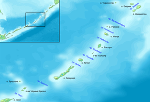
| Map of the Middle Kuril Islands with Russian names. In the center of the picture is the elongated island of Simushir. Boussole Street runs south of it. | ||
| Connects waters | Sea of Okhotsk | |
| with water | Pacific Ocean | |
| Separates land mass | Simushir | |
| of land mass | Tschirpoi , Broutona | |
| Data | ||
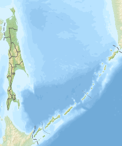
| Geographical location | 46 ° 42 ′ N , 151 ° 21 ′ E | |
|
|
||
| length | 30 km | |
| Smallest width | 68 km | |
The Boussole Strait ( Russian Буссоль ) is a strait between the Kuril Islands Simuschir in the northeast and Tschirpoi and Broutona in the southwest. It connects the Okhotsk Sea to the west with the Pacific Ocean in the east. Its width is 68 km.
The strait is named after the ship La Boussole ( French for “compass”), one of the two ships with which Jean-François de La Pérouse explored the Pacific region.
Web links
- Article Boussole Street in the Great Soviet Encyclopedia (BSE) , 3rd edition 1969–1978 (Russian)

