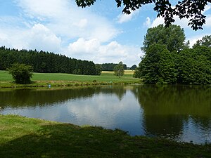
Bridge load pond
| Bridge load pond | ||
|---|---|---|

|
||
| View from the bridge load pond | ||
| Geographical location | Helmbrechts , District of Hof , Upper Franconia , Bavaria , Germany | |
| Tributaries | Enziusbach | |
| Drain | Enziusbach → Selbitz | |
| Location close to the shore | Dreschersreuth , Wüstenselbitz | |
| Data | ||
| Coordinates | 50 ° 12 '34.6 " N , 11 ° 40' 45.7" E | |
|
|
||
| length | 100 m | |
The Brücklasteich is a natural monument in the urban area of Helmbrechts in the Hof district .
The bridging load pond has been part of boundary descriptions from time immemorial. It was created on the old road which, like a dam in the swampy area, led to the formation of the pond. It is part of the list of natural monuments in the district of Hof . Here is the source area of the Enziusbach . The water supply was a necessity for the Jaythof desert as a potential rest stop.
Today the pond is on the district road HO 23 on the border of the urban area of Helmbrechts and Münchberg in the district of Hof and the district of Kulmbach . The closest localities are Burkersreuth and Wüstenselbitz on one side and Dreschersreuth and Hohenberg on the other. The boundaries correspond to those of the Margraviate Bayreuth-Kulmbach and the Bamberg Monastery . Until 1386/1388 the border of the Schauenstein rule was the Wolfstriegel .
literature
- Hans Seiffert : Helmbrechts - history of a small town in Upper Franconia , Helmbrechts 1921. P. 70f.
- Otto Knopf : Lexicon Frankenwald . Hof 1993. ISBN 3-929364-08-5 . P. 42.
Individual evidence
- ↑ Measured in the Bavaria Atlas of the Bavarian State Government ( notes )
