List of natural monuments in the district of Hof
The list of natural monuments in the district of Hof is an overview of the natural monuments in the district of Hof .
List of natural monuments in the district of Hof
| Surname | image | Identifier
|
details | position | Area hectares |
date | |
|---|---|---|---|---|---|---|---|
|
Linden tree |

|
01
|
Bad Steben , Carlsgrün 36 on Turnhallenweg in Carlsgrün |
??? | |||
| Weather spruce |

|
02
|
Bad Steben 374 300 m from the southwest exit of Bad Steben on the road to Geroldsgrün |
??? | |||
| Maple or Arles stone | 03
|
Berg , Tiefengrün 298, 299, 300 150 m northeast of the district road HO 11 Rudolphstein -Tiefengrün, where the road to Rudolphstein begins to fall |
??? | ||||
| Beech group | 04
|
Berg , Bruck 171 100 m south of the archangel property |
??? | ||||
| Bushes with an old sessile tree near Bug | 05
|
Berg , Bug 154 550 m northeast of Bug |
??? | ||||
| Double stem maple | 06
|
Feilitzsch , Münchenreuth 647/1 west of the Feilitzsch- Unterhartmannsreuth road , 250 m from the latter |
??? | ||||
| Exposure at Gattendorf | 07
|
Gattendorf 60 (t), 61 (t), 67 (t) and 70 (t) 250 m northwest of Kirchgattendorf |
??? | ||||
| Bergwald Schloßgattendorf |

|
08
|
Gattendorf 492, 493 (t), 497, 498, 501 (t) in the district of Schloßgattendorf (site of the castle ruins ) |
⊙ | |||
|
European beech |

|
09
|
Geroldsgrün , Langenbach 240/2 250 m south of the Langenbach cemetery on the edge of a terrace |
??? | |||
| 2 oaks, 2 maples | 10
|
Helmbrechts , Wüstenselbitz 879, 881, 883 in the immediate vicinity of the Geigersmühle |
??? | ||||
| Bookshaws | 11
|
Helmbrechts , Ahornberg 949 south of the Edlendorf - Almbranz community road |
??? | ||||
| chestnut | 12
|
Helmbrechts , Ahornberg 1278/6 on the east side of the former school building in Edlendorf |
??? | ||||
| Old alder | 13
|
Helmbrechts in 1875 on the north bank of the Schauenstein pond |
??? | ||||
| Upper course of the Enziusbach | 14th
|
Helmbrechts , Poppenreuth partial areas from 1012–1017 and 1024, Wüstenselbitz partial areas from 1280 and 1384–1395 creek from the south side of the district road HO 23 |
??? | ||||
| Bridge load pond |

|
15th
|
Helmbrechts , Wüstenselbitz 1259, 1260 (t), 1262 (t), 1263 (t), 1263/1 on the upper reaches of the Enziusbach , north of the district road HO 23 (see also Jaythof ) |
⊙ | |||
| Ahornismühle fen | 16
|
Helmbrechts , Wüstenselbitz 398 (t), 398/1 and 410 (t) northeast of the Ahornismühle |
??? | ||||
| European beech | 17th
|
Helmbrechts , Wüstenselbitz 53/6 square in front of the Wüstenselbitz schoolhouse |
??? | ||||
| Castle Park |

|
18th
|
Issigau , Reitzenstein 24, 25, 27, 81–90, 91/2, 92, 128, 130 within the village of Reitzenstein |
??? | |||
| Bismarck oak | 19th
|
Issigau 168 east of the war memorial in Issigau |
??? | ||||
| Luitpoldeiche | 20th
|
Issigau 104/2 in the courtyard of the Evang. Parish hall in Issigau, Kirchplatz 6 |
??? | ||||
| pulpit | 21st
|
Köditz , Brunnenthal 126 before the Göstra joins the Saale |
??? | ||||
| Rock group | 22nd
|
Köditz , Brunnenthal 203 350 m northeast of Obersaalenstein |
??? | ||||
| The old castle | 23
|
Köditz , Brunnenthal 190 at the confluence of the Göstra in the Saale |
??? | ||||
| Rock group at "The old castle" | 24
|
Köditz , Brunnenthal 190 at the confluence of the Göstra in the Saale |
??? | ||||
| Linden tree | 25th
|
Konradsreuth , Silberbach 583 6 m from the Oberpferdt 16 property , in the south-eastern part of the property |
??? | ||||
| Peace Oak | 26th
|
Konradsreuth , Gottfriedsreuth 184 Wölbersbach village center |
??? | ||||
| Oak | 27
|
Leupoldsgrün , Lipperts 56/1 at the Parkstrasse 5 property in Lipperts |
??? | ||||
| The high stone | 28
|
Leupoldsgrün , Leupoldsgrün 368, Lipperts 406, 407, 407/1 northwest of Leupoldsgrün |
??? | ||||
| Devil rock | 29
|
Lichtenberg 1458 Forest Department I 5 a, Kesselleite at Teufelssteg in Höllental |
??? | ||||
| Drachenfels | 30th
|
Lichtenberg 1473 Forest Department I 3 c, Kesselfels |
??? | ||||
| Stadthag with Schloßberg and castle ruins |

|
31
|
Lichtenberg 7, 7/2, 8-10, 14, 15, 18, 110/2, 174/2, 620 on the north-eastern outskirts of Lichtenberg |
⊙ | |||
| Kesselfels | 32
|
Lichtenberg 1473 Forest Department I 3 c, Kesselfels |
??? | ||||
| Alders | 33
|
Lichtenberg 427, 554, 556–558, 568, 569, 571 am Lohbach between Nailaer Straße and the Hague City Forest Department |
??? | ||||
| Gallows Mountain | 34
|
Lichtenberg 392, 407 on the southern outskirts |
??? | ||||
|
Peace Oak |

|
35
|
Münchberg , Straas 37/1 at the Straas fire station |
⊙ | |||
| Wild apple tree | 36
|
Münchberg , Meierhof 152 80 m west of the Meierhof 3 property |
??? | ||||
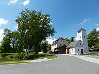
| Village oak |
|
37
|
Münchberg , Meierhof 2138 15 m south-west of the Laubersreuth fire-fighting equipment store |
⊙ | |||
| Linden tree | 38
|
Münchberg , Meierhof 2260 on the Hohberg , northeast of Laubersreuth , 280 m east of the A 9 motorway |
??? | ||||
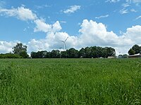
| Row of trees |
|
39
|
Münchberg , Meierhof 2088 north of the Gottersdorf 18 property , on Schweinereuthweg, approx. 250 m long row of trees |
??? | |||
| 2 beeches | 40
|
Münchberg , Poppenreuth 5 northwest of the Poppenreuth farm No. 3 on the way to the Pulschnitz-Einzel |
??? | ||||
| Village linden | 41
|
Münchberg , Poppenreuth 348 village center |
??? | ||||
|
Friedenslinde |

|
42
|
Münchberg , Straas 1043 town center of Solg , southeast of the fire brigade house |
⊙ | |||
| Linden tree | 43
|
Münchberg , Straas 1827 25 m south of the Biengarten 26 property |
??? | ||||
| Flaserkalk southeast of the lime kiln | 44
|
Naila 1288 (t) southeast of the Kalkofen 2 farmstead |
??? | ||||
|
2 maple, 1 ash |

|
45
|
Naila , Culmitz 685 at the Bärenhäuser 1 estate |
??? | |||
|
Peace Oak |

|
46
|
Naila , Lippertsgrün 13/26 town center Lippertsgrün |
??? | |||
| Garlesfelsen | 47
|
Naila , Marlesreuth 627 200 m southwest of the Garles homestead No. 2 |
??? | ||||
| Capping stone | 48
|
Naila , Marlesreuth 589 1300 m east of the center of Marlesreuth; north of the district road HO 33 Marlesreuth- Selbitz |
??? | ||||
|
Linden tree |

|
49
|
Oberkotzau 910, 911 trigometric point approx. 1.5 km west of the Oberkotzau train station , at Höfer Weg |
⊙ | |||
|
Eclogite exposure |

|
50
|
Oberkotzau , Fattigau 339 on the western outskirts of Fattigau |
⊙ | |||
|
Bismarck oak |

|
51
|
Oberkotzau at the Eppenreuther Weg-Höfer Weg intersection |
⊙ | |||
|
Outcrop in the coal lime northwest of Trogenau |

|
52
|
Regnitzlosau , Vierschau 498 (t) and 500 (t) 1.0 km northwest of Trogenau |
⊙ | |||
|
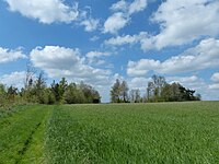
Devonian u. Coal extraction at Osseck aW |
|
53
|
Regnitzlosau , Draisendorf 792, 793 weekend house area Osseck |
⊙ | |||
| Rock on the stone house | 54
|
Regnitzlosau 698/4 on the state road St 2192, opposite the confluence of the Kalkofenweg |
??? | ||||
| Oak near the forest house | 55
|
Rehau , Rehauer Forst 1 am Waldhaus, south of boundary stone No. 6 |
??? | ||||
| Peace Oak | 56
|
Rehau , Pilgramsreuth 113 Exit Pilgramsreuth, direction Wüstenbrunn , left |
??? | ||||
| "Schwarzteich" fen | 57
|
Rehau 3222 (t), 3222/2 (t), 3223 northeast of Seelohe , in the Löwitzgrund |
??? | ||||
| Double-stemmed pine | 58
|
Rehau , Kühschwitz 144 left of the federal road B 15 Rehau-Hof near Kühschwitz |
??? | ||||
| Peace Oak | 59
|
Rehau , Wurlitz 59 in Wurlitz |
??? | ||||
| Linden tree near Pilgramsreuth | 60
|
Rehau , Pilgramsreuth 164 east of Pilgramsreuth No. 49, on the old road to Fohrenreuth |
??? | ||||
| Chapel rock | 61
|
Rehau , Rehauer Forst 100, 102 on the B 15 federal road, southeast of Perlenhaus |
??? | ||||
|
Rock "Sleeping Giant" |
62
|
Schauenstein 777 on the southern outskirts, at the end of the local street "Am Goldberg" |
??? | ||||
|
Rocks Rock group "Wachende Jungfrau" |

|
63
|
Schauenstein 56 on the western outskirts in the park "Am Hohen Stein" |
??? | |||
| Ribbon gneiss | 64
|
Schwarzenbach an der Saale , Seulbitz 392 on Gottfriedsreuther Weg, at the farm building of the "Alpenrose" shooting club |
??? | ||||
|
Burgstall |

|
65
|
Schwarzenbach an der Saale , Förbau 213 approx. 150 m west of the company building of the water management office in Hof an der Förmitztalsperre |
⊙ | |||
| Beech group |

|
66
|
Schwarzenbach an der Saale , Hallerstein 23 on the northern slope of the Schlossberg in Hallerstein |
??? | |||
|
Village linden |

|
67
|
Schwarzenbach an der Saale , Hallerstein 50 South exit of Hallerstein |
⊙ | |||
| Pine | 68
|
Schwarzenbach an der Saale , Hallerstein 247 approx. 160 m northwest of the Turnerheim Hallerstein farm building |
??? | ||||
| Oak | 69
|
Schwarzenbach an der Saale , Quellenreuth 7 150 m north-northwest of the junction of the municipal road from the federal road B 289, in the direction of Quellenreuth |
??? | ||||
|
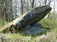
Rock section "frog and mouse" |
|
70
|
Schwarzenbach an der Saale 502/16 west of the Bundesbahn from Hof, before Schwarzenbach / Saale, approx. 100 m north of Rehauer Strasse |
??? | |||
|
Schloßberg with "Schwamma" |

|
71
|
Schwarzenbach am Wald , Schwarzenstein 2 Oberschwarzenstein, see also Schwarzenstein Castle |
??? | |||
|
yew |

|
72
|
Schwarzenbach am Wald , Bernstein 276 west of the Breitengrund 1 property |
??? | |||
| Gallows Mountain Summit | 73
|
Schwarzenbach am Wald , Bernstein 175 west of Bernstein / Wald |
??? | ||||
| Bamberger Tor, Hirschsteinkoppe and Romansfelsen | 74
|
Schwarzenbach am Wald , Bernstein 246/2, 246/3 west of Bernstein / Wald |
??? | ||||
|
Earth fold |

|
75
|
Schwarzenbach am Wald , Löhmar 126/2 east of the Zegastbrücke, in the course of the Wald former federal highway B 173 |
??? | |||
| beech | 76
|
Sparneck 944 approx. 150 m south of the Waldhotel "Heimatliebe", in the northeast corner of the property |
⊙ | ||||
|
Rock "Kleiner Waldstein" |

|
77
|
Sparneck , Sparnecker Forst 10 on the Kleiner Waldstein, District VII Kleiner Waldstein, Section 3, Brandiger Stump at Grenzstein No. 564 |
⊙ | |||
|
Willow fountain |
78
|
Sparneck , Sparnecker Forst 34 in Staatswaldabteilung VII 14 a Reutberg, approx. 30 m northwest of the Höhenweg |
⊙ | ||||
| Friedenseiche in Weickenreuth | 79
|
Stammbach , Förstenreuth 547 Weickenreuth town center |
??? | ||||
| beech | 80
|
Stammbach , Gundlitz 551 south of the Herrnschrot 49 property |
??? | ||||
| Double trunk oak | 81
|
Stammbach , Straas 1447, 1454 east of Stammbach, on the Bamberg - Hof railway line |
??? | ||||
| maple | 82
|
Stammbach , Straas 1702 on Schweinsbacher Weg, 200 m northeast of the motorway bridge, next to it a younger sweet cherry |
??? | ||||
| Schafhübel | 83
|
Trogen 953 northeast of the Gumpertsreuth -Trogen street, 350 m before the junction with Plauener Straße |
??? | ||||
| Schwarzenstein | 84
|
Trogen 678 2.1 km northeast of Trogen |
??? | ||||
| Druid Rock | 85
|
Zell im Fichtelgebirge , Sparnecker Forst 50 400 m west of the Waldsteinhaus , directly on the road to the television tower / Zeller Steig intersection, in the state forest department VI 19, bear catching |
??? | ||||
| Jump | 86
|
Zell im Fichtelgebirge , Sparnecker Forst 41 approx. 600 m east of the Waldsteinhaus in District VI, Großer Waldstein , Section 6 Schüssel |
??? | ||||
|
Saalequelle and surroundings |
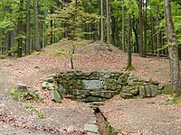
|
87
|
Zell im Fichtelgebirge 952 Münchberg municipal forest |
⊙ |
|
||
| Bruckschlagfelsen | 88
|
Zell im Fichtelgebirge , Sparnecker Forst 50 750 m northwest of the Waldsteinhaus in the state forest department VI 20 b, Bruckschlag |
??? | ||||
| Libra | 89
|
Zell im Fichtelgebirge , Sparnecker Forst 41 375 m east of the Waldsteinhaus |
??? | ||||
| Bear trap rock | 90
|
Zell im Fichtelgebirge , Sparnecker Forst 50 150 m west of the Waldsteinhaus in the state forest department VI 19, Bärenfang |
??? | ||||
|
Arnsteinfels |

|
91
|
Zell im Fichtelgebirge , Sparnecker Forst 50 700 m west of the Waldsteinhaus or 50 m west of the Bärenweg in the state forest department VI 18 a, Arnsteinfels |
⊙ | |||
|
Combs rock |
92
|
Geroldsgrüner Forst 72 above the community road Geroldsgrün - Langenau |
??? | ||||
|
Burgsteinfels |

|
93
|
Geroldsgrüner Forst 72 approx. 400 m south of the so-called Forst Langenaustraße, Abzw. Burgsteinweg |
??? | |||
|
Stalactite cave Alexander v. Humboldt Cave south of Langenau |

|
94
|
Geroldsgrüner Forst 129 Access in the Rauhberg forest section, approx. 100 m above (south) the marble quarry at the bottom of the tunnel |
⊙ | |||
| Pulpit | 95
|
Geroldsgrüner Forst 190 approx. 650 m south of Wolfersgrüner Straße, on the eastern slope to the fire control department |
??? | ||||
|
Ring castle on the Schloßbergkegel |

|
96
|
Geroldsgrüner Forst 158 Summit area of the Schloßberg forest department |
⊙ | |||
| Beech fountain | 97
|
Hallersteiner Forst - Northwest 1 on the Höhenweg, 500 m east-northeast of the Münchberg - Kirchenlamitz road or approx. 1.6 km northwest of the village of Förmitz |
??? | ||||
|
Gypsy stone |

|
98
|
Martinlamitzer Forst 35 500 m southwest of the Kornbergturm- Hirschstein path , a granite block popularly known as "Wackelstein" |
??? | |||
| Legend for natural monument | |||||||
See also
- List of nature reserves in the district of Hof
- List of landscape protection areas in the district of Hof
- List of FFH areas in the district of Hof
- List of geotopes in the district of Hof
- List of landscape protection areas in Hof (Saale)
- List of geotopes in Hof
- List of natural monuments in Hof (Saale)
literature
- Official journal of the district of Hof, edition 8/2012: Ordinance on the natural monuments in the area of the district of Hof .
- Emil Seuss: Directory of natural monuments of the district of Münchberg (November 1, 1960) In: Plant world . Issue series: Between Waldstein and Döbraberg . Pp. 44-46.
Web links
Commons : Natural monuments in the district of Hof - Collection of images, videos and audio files