List of natural monuments in the Traunstein district
The list of natural monuments in the Traunstein district names the natural monuments in the towns and communities in the Traunstein district in Bavaria . In 2018 there were 60 natural monuments in the Traunstein district. According to Art. 51 Para. 1 No. 4 BayNatSchG, the District Office of the Traunstein District is responsible for issuing legal ordinances on natural monuments (§ 28 BNatSchG).
list
| image | number | designation | local community | Location | description |
|---|---|---|---|---|---|

|
ND-00125 | Linde in Kötzing | Chieming | District Hart, Fl. No. 383 47 ° 56 '7.2 " N , 12 ° 33" 10.1 " E |
Estimated age approx. 400 years, trunk circumference 7.02 m |
| ND-00126 | Oak north of Chieming | Chieming | District Chieming, Fl. No. 1228 47 ° 53 '45.4 " N , 12 ° 32' 7.9" O |
The oak is located on the western edge of the property, Chieming, Lindenstrasse 7 | |

|
ND-00127 | Dead ice silting up Schwarzelmoos northwest of Chieming | Chieming | 47 ° 53 '45.5 " N , 12 ° 31' 46.9" E | |
 more pictures |
ND-00128 | Kalkflachmoor with wet meadow northwest of Egerer | Chieming | 47 ° 54 '31.8 " N , 12 ° 31' 46.7" E | |

|
ND-01259 | Oak in Eiting | Engelsberg | 48 ° 7 '20 " N , 12 ° 32' 12.2" E | |
| ND-00207 | Round humps and natural ice kettle east of Hausmann | Inzell | Inzell district, Fl. No. 327 | ||
| ND-00099 | Bach floodplain, reed bed and spring meadows south-southwest of Hernöd | Kirchanschöring | 47 ° 57 '10.5 " N , 12 ° 49' 9.9" E | ||
| ND-01260 | Litter meadow with transitional moorland north of Reiterberg | Obing | 48 ° 1 '19.1 " N , 12 ° 21' 24.6" E | ||

|
ND-00100 | Raised moor east of Harpfetsham parish | Palling | 47 ° 59 ′ 7.8 " N , 12 ° 40 ′ 22.1" E | |
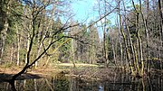
|
ND-00101 | Three dead ice siltations east of Harpfetsham | Palling | 47 ° 58 ′ 57 " N , 12 ° 40 ′ 24.8" E | |

|
Silted up lake near Heigermoos | Palling | 48 ° 2 '22.3 " N , 12 ° 40' 45.8" E | ||
| ND-00093 | Linden tree in Schönram | petting | 47 ° 53 '8.4 " N , 12 ° 50' 48" E | ||
| Spirkenhochmoor east of Aichbauer | petting | ||||
| ND-01264 | Transitional moor southwest of the Hinzing district | Pittenhart | |||
| ND-01326 | Trees on the B 305 Reit im Winkl - Seegatterl | Reit im Winkl | a total of 7 linden trees, 15 ash trees, 1 maple | ||
| ND-01327 | Spring complex with limestone moor and semi-arid grass north of the Glapf-Hof | Reit im Winkl | |||
| ND-01328 | Kalkflachmoor northwest of the Glapfhof | Reit im Winkl | |||
| ND-01268 | Lime flat moor and lime spring meadows northwest of Brand | Ruhpolding | |||
| ND-01269 | High and transition moor east of Gstatt | Ruhpolding | |||
| Three linden trees in front of the St. Valentin church in the Zell district | Ruhpolding | Marking Zell 47 ° 45 ′ 24.1 ″ N , 12 ° 39 ′ 45.6 ″ O |
|||
| ND-01266 | Buckelwiese west of Schleching | Schleching | |||
| ND-01267 | Schwallweiher east of Achberg | Schleching | 47 ° 42 ′ 43.2 " N , 12 ° 24 ′ 34.9" E | ||
| Kalkflachmoor with spring horizons west of Schleching | Schleching | ||||
| ND-00129 | Linden tree in the Pavolding district | Seeon-Seebruck | 47 ° 57 '28.7 " N , 12 ° 26' 22.5" E | ||

|
ND-00131 | Toteisloch southwest of Klosterseeon | Seeon-Seebruck | 47 ° 58 '16.3 " N , 12 ° 26' 28.1" E | |
| ND-00103 | Slope spring moor near beeches | Surberg | 47 ° 52 '6.1 " N , 12 ° 42' 46.9" E | ||
| ND-00104 | Steilhangquellmoor near Nutz | Surberg | 47 ° 52 '3.2 " N , 12 ° 43' 30.6" E | ||

|
ND-00105 | Soliges high moor south of Tandlmaier | Surberg | 47 ° 51 ′ 21 " N , 12 ° 42 ′ 31.6" E | |

|
ND-00106 | Kuschelhochmoor with transition moor north of Abstreit | Surberg | 47 ° 50 '50.9 " N , 12 ° 41' 50.8" E | |
| ND-00107 | Slope spring litter meadow, tufa spring corridors, fragments of gorge forest southeast of Au (Burghartswiesen) | Surberg | 47 ° 51 '38.1 " N , 12 ° 41' 39.2" E | ||

|
ND-00108 | Latschenhochmoor and Niedermoor south of Hochöd | Surberg | 47 ° 51 '4.6 " N , 12 ° 41' 43.7" E | |
| ND-00109 | Latschenhochmoor south of Langmoos | Surberg | 47 ° 53 '37.6 " N , 12 ° 40' 45.4" E | ||
| ND-00110 | Kalkquellmoor near thesebach | Surberg | 47 ° 51 '20.4 " N , 12 ° 44' 13.3" E | ||
|
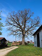
ND-01262 | Oak in Witzmoning | Tacherting | 48 ° 4 '6.4 " N , 12 ° 29" 38.2 " E | |

|
ND-01263 | Lindenallee southeast of Neudeck | Tacherting | 48 ° 5 '12.1 " N , 12 ° 30' 16.2" E | |
| ND-00111 | Slope spring moor (Kalkflachmoor) southeast of Bermoos | Taching at the lake | |||
| ND-00112 | Lime spring moor with swamp forest strips north of Mühlthal | Taching at the lake | |||
| ND-00113 | Silted up moraine pond southeast of the house | Taching at the lake | |||
| ND-01309 | Irrblock east of Lanzing | Tittmoning | District Kay, Fl. No. 1867 |
||
| ND-01310 | Irrblock east of Lanzing | Tittmoning | District Kay, Fl. No. 1695 |
||
| ND-01311 | Oak north-east of Brunn | Tittmoning | District Asten, Fl. No. 109 |
||
| ND-01312 | Juniper heather in Unteröd | Tittmoning | 48 ° 1 '2.4 " N , 12 ° 42' 56.6" E | ||
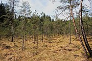
|
ND-01313 | Pfaffelmoos west of Unteröd | Tittmoning | 48 ° 1 '1.8 " N , 12 ° 42' 17.4" E | |
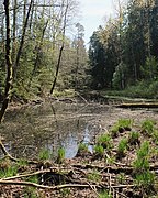
|
ND-01314 | Alder forest east of Holzweber | Tittmoning | 48 ° 3 '40.5 " N , 12 ° 42' 23.6" E | |
| ND-01315 | Alder forest east of Stetten | Tittmoning | |||
| ND-01317 | Dead ice holes and swamp forest with transition moor northwest of Wallmoning | Tittmoning | |||
| ND-01319 | Sedge silting southwest of Kobeln | Tittmoning | |||
| ND-01320 | Semi-arid grassland north of Murschall | Tittmoning | |||
| ND-01321 | Semi-arid grassland on the southern slope of the Weinleite east of Lanzing | Tittmoning | |||
| ND-01322 | Kalkflachmoor with transition moor northeast of the Leitgeringer See | Tittmoning | |||
| ND-01323 | Gorge forest and tufa spring meadows northeast of Klaffmühle | Tittmoning | |||
|
ND-00133 | Rows of trees on the slopes to the west and south-east of the hamlet of Pertenstein | Traunreut |
47 ° 56 '30 " N , 12 ° 35' 28.2" E 47 ° 56 '28 " N , 12 ° 35' 36.6" E |
|
| ND-00115 | Transitional and low moor northwest of the clash | Traunstein | 47 ° 50 '36.9 " N , 12 ° 41' 3.9" E | ||

|
ND-00116 | Latschenhochmoor and litter meadow southeast of Preising | Traunstein | 47 ° 50 '55.7 " N , 12 ° 41' 27.9" E | |

|
ND-00134 | Oak north-west of Höpperding | Traunstein | 47 ° 53 '16.9 " N , 12 ° 36' 34.4" E | |
| Kalkflachmoor with high moor area west of Langmoos | Traunstein | 47 ° 53 '59 " N , 12 ° 40' 2.8" E | |||
| ND-01306 | Yew trees in Brunnleiten near Bergham | Trostberg | Heiligkreuz district 48 ° 3 ′ 18.9 ″ N , 12 ° 34 ′ 59.2 ″ E |
||
| ND-01265 | Eglsee with raised and transitional moor and litter meadow west of Brem | Underweave | 47 ° 42 ′ 59.9 " N , 12 ° 28 ′ 15.5" E | ||
| ND-00135 | Semi-arid grassland on the Gaisberg | Vachendorf | 47 ° 50 '50.5 " N , 12 ° 36' 17.7" E | ||
 more pictures |
ND-00132 | Irrblock "Bitterstein" WNW von Holzhausen | Waging by the lake | 47 ° 57 '35.6 " N , 12 ° 39" 8.7 " E | |
| Limestone moor shoreline north of Seeleiten | Waging by the lake | 47 ° 56 '4.8 " N , 12 ° 46" 6.3 " E | |||

|
ND-00117 | Latschenhochmoor southwest of Weibhausen | Wonneberg | 47 ° 53 '42 " N , 12 ° 41' 4.6" E |
See also
- List of nature reserves in the Traunstein district
- List of landscape protection areas in the Traunstein district
- List of FFH areas in the Traunstein district
- List of geotopes in the Traunstein district
Web links
Commons : Natural monuments in the Traunstein district - collection of images, videos and audio files
Individual evidence
- ↑ Landkreis Traunstein: Protected Areas ( Memento from February 28, 2014 in the Internet Archive ), accessed on September 29, 2018.
- ↑ Google map of the locations of the natural monuments in the Traunstein district at altoetting.bund-naturschutz.de: excursion overviews , natural monuments, links, ... , accessed on November 4, 2018.
- ↑ Landkreis Traunstein: Naturdenkmäler ( Memento from March 22, 2016 in the Internet Archive ) (PDF; 917 kB), accessed on September 29, 2018.
- ↑ Ordinance of the Traunstein District Office on the protection of the old linden trees in front of the St. Valentin church in the Zell district in the Ruhpolding community as a natural monument from January 8, 2018 in: Official Journal for the Traunstein District , January 19, 2018, accessed on August 25, 2019 (PDF; 641 kB)
