
Fattigau
|
Fattigau
Oberkotzau market
Coordinates: 50 ° 14 ′ 31 ″ N , 11 ° 56 ′ 5 ″ E
|
|
|---|---|
| Height : | 489 (488-497) m |
| Residents : | 160 |
| Incorporation : | January 1, 1972 |
| Postal code : | 95145 |
| Area code : | 09286 |
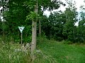
 Entrance
|
|


Fattigau is a district of the Oberkotzau market in the Hof district in Upper Franconia .
geography
The Lamitz flows into the Saale at Fattigau . State road 2177 runs through the village . The place had a stop on the Bamberg – Hof railway line .
history
Fattigau was first mentioned in a document in 1353 when family members of the von Kotzau family were named as owners. A first well-fortified knight's seat was probably built above the town around 1320 by Heinrich von Kotzau on an imperial order as an imperial fief. This rule also included 16 farms in the surrounding areas. In the Landbuch von Hof from 1502 the seat, Vorwerk and 13 "teams" (property) are recorded. The family was fiefdom until the 17th century. Initially there were tensions between imperial-free property and the claims of the burgraviate of Nuremberg , but the residence of Margrave Georg Friedrich I was destroyed in 1557 because Georg Wolf von Kotzau had opposed Albrecht Alcibiades in the Second Margrave War . Margrave Christian Ernst finally came into the possession of Fattigau through sale , after which it belonged to the von der Recke , von Preysing families and the barons of Kotzau, newly established by the Hohenzollerns . One of the owners was the bailiff of Stockenroth and Hallerstein , Hans Heinrich Müffling called Weiß († 1637). Eventually the estate in Fattigau came into the possession of Johann Seidel and there was an upswing in bourgeois ownership. With the abdication of the last Bayreuth Margrave Alexander, the region was briefly Prussian and then placed under Napoleonic administration before it fell to Bavaria . During the territorial reform, the place lost its independence on January 1, 1972 and was incorporated into Oberkotzau. Today Fattigau has about 160 inhabitants and three larger businesses, including the Stelzer Castle Brewery .
The knightly residence originally served as the outworks of the castle in Oberkotzau , later the castle was the administrative seat. August Gebeßler listed the inn as a former farmyard and a residential stable from the 17th century as further architectural monuments . The farm yard and the palace construction date largely from the second half of the 18th century, but essentially go back to the 16th / 17th century. Century back. The special features of both buildings are wooden ceilings with beams .
Attractions
There are deposits of eclogite in Fattigau and the neighboring places such as Haideck or Autengrün . Geologically, the area is part of the Münchberg plateau or the Münchberger mass .
Geotope
On the western outskirts of Fattigau there is an outcrop in a small former quarry , which is designated as a natural monument and geotope (475A030). The geotope is classified as important and rare in both geoscientific and local history.
Close up of the entrance area

Town view with overgrown quarry

Quarry in spring


The Jean-Paul-Weg leads through Fattigau. The Schwarzenbach landscape painter Anton Richter made pictures of the place and its surroundings.
Personalities
- Christian Endemann (1885–1950), born in Fattigau, German politician (SPD)
literature
- August Gebeßler : City and District of Hof . The Art Monuments of Bavaria , Brief Inventories , Volume VII . German art publisher . Munich 1960. p. 41.
- Dietmar Herrmann, Helmut Süssmann: Fichtel Mountains, Bavarian Vogtland, Steinwald, Bayreuther Land. Lexicon . Ackermannverlag, Hof (Saale) 2000, ISBN 3-929364-18-2 , p. 150 .
- Hans Hofner : From the history of the oldest feudal farms around Hof - Fattigau near Oberkotzau . Article in the Frankenpost .
- Wilhelm Malter : Upper Franconia East . Heroldsberg 1984. p. 344.
- Friedrich von Schönburg-Waldenburg, Rudolf Timper: History of Schwarzenbach an der Saale . Schwarzenbach an der Saale 1908. p. 128.
- Hans-Ulrich Zeidler: Fattigau - a local history . In: Heimatkalender für Fichtelgebirge, Frankenwald and Vogtland , 2011. Hof 2010. pp. 79–88.
Web links
Individual evidence
- ^ Wilhelm Volkert (ed.): Handbook of Bavarian offices, communities and courts 1799–1980 . CH Beck, Munich 1983, ISBN 3-406-09669-7 , p. 485 .
- ↑ http://www.schlossbrauerei-stelzer.de/
- ^ [1] at the Bavarian State Office for the Environment

Auten green | Fattigau | Haideck | Herrenlohe | Lerchenberg | Oberkotzau | Pfaffengrün | Wustuben