
Brumunddal
| Brumunddal | |||||
|---|---|---|---|---|---|
|
|||||
| Basic data | |||||
| Country | Norway | ||||
| Province (fylke) | Domestic | ||||
| Municipality (commune) : | Ringsaker | ||||
| Coordinates : | 60 ° 53 ' N , 10 ° 56' E | ||||
| Residents : | 9,282 (2012) | ||||
| Area : | 7.25 km² | ||||
| Population density : | 1280 inhabitants per km² | ||||
| traffic | |||||
| Railway connection: | Dovrebanen | ||||


Brumunddal is the administrative center and the largest town in the municipality of Ringsaker in the province of Innlandet in southeastern Norway at the mouth of the Brumunda River and Lake Mjøsa . In addition to tourism, there is agriculture and forestry in Brumunddal.
8,890 inhabitants (2009) live on 7.25 km². The zip code is 2380.
From 1992 to 1994 there was the Aksjonsplan Brumunddal , a school project against bullying, discrimination and racism . Brumunddal and Brumunddal på nye veier ( Brumunddal on new paths ) succeeded in curbing racism and becoming examples of places with similar problems.
People from Brumunddal
- Gaute Ormåsen , Norwegian singer
- Sigbjørn Johnsen , Norwegian politician of the Arbeiderpartiet
Web links
- Ringsaker Municipality (in Norway)
gallery

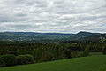
View of Brumunddal
View of the Brumunddal countryside

Church in Brumunddal (Brumunddal kirke)

Brumunddal train station (Brumunddal stasjon)


