Brunnenkopf (mountain)
| Well head | ||
|---|---|---|
|
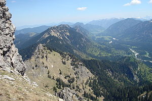
View from the ascent to Klammspitze to Brunnenkopf and Brunnenkopf houses |
||
| height | 1718 m above sea level NN | |
| location | Bavaria , Germany | |
| Mountains | Ammergau Alps | |
| Coordinates | 47 ° 34 '59 " N , 10 ° 55' 26" E | |
|
|
||
| Normal way |
Linderhof Palace - Brunnenkopfhäuser - Brunnenkopf |
|
The Brunnenkopf is a 1718 m high mountain above the Graswang Valley in the Ammergau Alps near Oberammergau in the Garmisch-Partenkirchen district .
summit
The summit can be reached as a simple mountain hike from Linderhof Palace ( 980 m ) via the Brunnenkopfhaus ( 1602 m ). The trail begins right at the hut entrance and leads west to the highest point with the summit cross. The last few meters over rocky exposed ridge are secured with a wire rope.

