Burgh by Sands
Coordinates: 54 ° 55 ′ N , 3 ° 4 ′ W
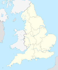
Location in England
|
Burgh by Sands [ bɹʌf ] is a municipality in the district of City of Carlisle County Cumbria , England , near the Solway Firth . The parish consists of the localities of Burgh by Sands, Longburgh , Dykesfield , Boulstead Hill , Moorhouse and Thurstonfield .
In 2011 Burgh by Sands had 1,176 inhabitants.
history
The Hadrian's Wall runs through the village, here at that time was a Roman fort , Aballava . The English King Edward I died on July 7, 1307 on the Marshes of Burgh on his last campaign against the Scots and was buried in the 12th century church until he was transferred to Westminster Abbey .
etymology
Burgh is "undoubtedly named after the" burh "or fort on Hadrian's Wall that ended here." ('Burh' is Old English for 'fortified place', 'city' or 'mansion').
St. Michael Church
The church of St. Michael was built from stone from the Roman wall on the site of a Norman church. It has a broad tower with a mid-14th century plinth, and apart from the 18th century east windows, the rest is Early English. The tower, which can only be reached from the church, is used for defense and the ground floor has a tunnel vault. The top of the tower probably dates from the 18th century.
government
The parish falls within the constituency of Burgh. This parish stretches across the boundaries of Burgh by Sands with a total population recorded at the 2011 census of 2,117.
Infrastructure
At one time, Burgh-by-Sands had a station on the North British Railway
Public transport currently consists of a bus service from Carlisle. From September 2018 it will be operated by Stagecoach four times a day.
See also
- Listed buildings in Burgh by Sands
- Drumburgh
- List of English and Welsh endowed schools (19th century)
- North End, Cumbria
Web links
Individual evidence
- ↑ Local Statistics - Office for National Statistics. Retrieved June 12, 2019 .
- ^ <italic> The Place-Names of Buckinghamshire </italic>. By <sc> A. Mawer </sc> and <sc> FM Stenton </sc>. [English Place-Name Society, vol. II.] (Cambridge: Cambridge University Press. 1925. Pp. Xxxii, 274. 18s.) And <italic> The Place-Names of Bedfordshire and Huntingdonshire </italic>. By A. Mawer and FM Stenton. [English Place-Name Society, vol. III] (Cambridge: the University Press. 1926. Pp. Xxvii, 316. 18s) . In: The American Historical Review . January 1927, ISSN 1937-5239 , doi : 10.1086 / ahr / 32.2.302 .
- ^ Pevsner, Nikolaus, 1902–1983 .: Cumberland and Westmorland. Penguin, Harmondsworth 1967, ISBN 0-14-071033-7 .
- ↑ Good Stuff IT Services: Burgh - UK Census Data 2011. Accessed June 12, 2019 .
