Buschhausen (Heiden)
|
Buschhausen
Parish Heiden
Coordinates: 51 ° 48 ′ 24 ″ N , 6 ° 56 ′ 1 ″ E
|
||
|---|---|---|
| Height : | 69 m | |
| Postal code : | 46359 | |
| Area code : | 02867 | |
|
Location of Buschhausen in North Rhine-Westphalia |
||
|
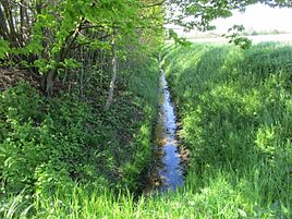
The Engelradingbach in Buschhausen
|
||
Buschhausen is a hamlet in the peasantry Leblich south of the community Gentiles in Münsterland , Westphalia .
geography
Geographical location
The hamlet of Buschhausen is located in the fields south of the village of Heiden and just north of the Reker Feld forest in the Hohe Mark Nature Park in the Westphalian Bay. The scattered settlement Leblich, to which it belongs, extends around Buschhausen .
Neighboring places
|
Street village Heiden on Bahnhofstraße (to Heiden ) |
Parish Heiden |
|
|
Marbeck village (to Borken ) |

|
Hamlet Leblich (to pagans ) |
|
municipality Raesfeld |
Village Rhade (to Dorsten ) |
Lembeck village (to Dorsten ) |

