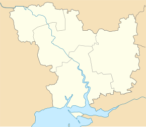
Buske (Voznesensk)
| Buske | ||
| Бузьке | ||

|
|
|
| Basic data | ||
|---|---|---|
| Oblast : | Mykolaiv Oblast | |
| Rajon : | Voznesensk Raion | |
| Height : | 49 m | |
| Area : | 3.772 km² | |
| Residents : | 2,043 (2001) | |
| Population density : | 542 inhabitants per km² | |
| Postcodes : | 56541 | |
| Area code : | +380 5134 | |
| Geographic location : | 47 ° 37 ' N , 31 ° 12' E | |
| KOATUU : | 4822080801 | |
| Administrative structure : | 2 villages | |
| Address: | площа Центральна буд. 1 56541 с. Бузьке |
|
| Website : | Website of the rural community of Buske | |
| Statistical information | ||
|
|
||
Buske ( Ukrainian Бузьке ; Russian Бугское Bugskoje ) is a village in the Ukrainian Oblast of Mykolaiv with about 2000 inhabitants (2001).
The village, founded at the end of the 17th century (another source mentions the year 1790), has been the administrative center of the rural municipality of the same name in Voznesensk Raion since 2017 , to which the village of Taborivka ( Таборівка , ⊙ ) with about 1,800 inhabitants belongs.
The village is located on the left bank of the Southern Bug , 12 km northwest of the Voznesensk district center and 100 km northwest of the Mykolaiv oblast center . The national trunk road N 24 runs through the municipality .
Web links
Commons : Buske - collection of pictures, videos and audio files
- Buske on the Rajon Administration website (Ukrainian)
- Website of the (former) municipal council on rada.info (Ukrainian)
Individual evidence
- ↑ a b local website on the official website of the Verkhovna Rada ; accessed on September 29, 2018 (Ukrainian)
- ^ Local history Buske in the history of the cities and villages of the Ukrainian SSR ; accessed on September 29, 2018 (Ukrainian)
- ^ Website of the rural community on gromada.info ; accessed on September 29, 2018 (Ukrainian)
- ↑ http://w1.c1.rada.gov.ua/pls/z7503/A005?rf7571=22099


