Cabo Rojo
| Cabo Rojo | ||
|---|---|---|
 seal |
 flag |
|
| Location in Puerto Rico | ||
|
|
||
| Basic data | ||
| Foundation : | December 17, 1771 | |
| State : | United States | |
| Outside area : | Puerto Rico | |
| Coordinates : | 18 ° 5 ′ N , 67 ° 9 ′ W | |
| Time zone : | Atlantic Standard Time ( UTC − 4 ) | |
| Residents : | 46,911 (as of: 2000) | |
| Population density : | 257.5 inhabitants per km 2 | |
| Area : | 459.47 km 2 (approx. 177 mi 2 ) of which 182.21 km 2 (approx. 70 mi 2 ) is land |
|
| Height : | 20 m | |
| Postal code : | 00623 | |
| Area code : | +1 787 | |
| FIPS : | 72-09861 | |
| GNIS ID : | 1609670 | |
| Website : | www.caborojopr.com | |
| Mayor : | Roberto "Bobby" Ramírez Kurtz ( PPD ) | |
 Cabo Rojo lighthouse |
||
Cabo Rojo is a city in western Puerto Rico .
geography
Geographical location
Cabo Rojo is on the Caribbean coast of the island, south of Mayagüez and Hormigueros , west of San Germán and Lajas .
geology
The red rocks on the coast gave the city its name ( cabo rojo, Spanish for "red cape").
City structure
Cabo Rojo spans 18 boroughs including downtown Cabo Rojo Pueblo.
|
|
|
history
Cabo Rojo was founded on December 17, 1771 by Nicolás Ramírez de Arellano and Miguel de Muesas .
According to an old legend, there was a dispute between the Cabo Rojos and the people of Lajas at the salt mine. The Caborojanians who fight with axes were nicknamed mata con hacha (those who kill with the ax).
politics
Coat of arms, flag and anthem
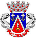
The red triangle symbolizes the cabo bermejo in Los Morillos. The blue and white colors, together with the anchors, represent the sea. The flaming sword is an attribute of the city patron San Miguel de Arcángel. The crown is the symbol of parish status.
In the flag, the colors are used with the same meaning, only the anchor, sword and crown are missing.
The anthem was written by Mildred Arroyo Cardoza.
Hoy estoy triste por la distancia
que me separa de mi dulce patria,
y de un pueblito donde mi
padre y mi madre me esperan
Mi Cabo Rojo pueblo adorado,
jardín de flores te quiero yo
y en la distancia a ti te añoro,
por eso lloro en mi cantar.
Son tus palmeras flores divinas
y son tus playas, un manantial
Mi Cabo Rojo, me siento solo
por eso lloro en mi cantar
pero muy pronto besaré tu suelo
o desde el cielo te adoraré.
Culture and sights
Buildings
The most famous structure in Cabo Rojo is the Los Morrillos lighthouse. The tower, built in 1881 and equipped with electric light in 1961, which the locals call El Faro , rises 60 meters above sea level on the limestone rock.
The Catholic Church of San Miguel Arcángel is the successor to the Church of San José, built in 1783.
Natural monuments
In Cabo Rojo, in addition to the beaches of Boquerón, El Combate, Joyuda, Punta Arenas and Punta Real, you can explore the Cofresí cave, the Joyuda lagoon and the Ratones island.
Sports
From 1989 to 1993 there was the first division basketball team Los Turistas de Cabo Rojo .
Regular events
- Pescao Festival - March
- Años Cuarenta Festival - April
- Chigüero Festival - April
- Betances Festival - April
- Oyster Festival - May
- Boquerón Bay Crossing - July
- Watermelon Festival - July
- Retorno a la Arena - July
- Patron Festivities - September
- Paleta Festival - December
- Le Lo Lai Festival - December
Economy and Infrastructure
The salt mines ( Salinas ) near the lighthouse are considered to be the oldest industry in the New World. They have been in continuous operation since the Taínos era . The Puerto Real district in particular is known for fishing.
Personalities
sons and daughters of the town
- Ramón Emeterio Betances (1827–1898), independence fighter
- Roberto Cofresí Ramírez De Arellano (1791-1825), pirate
- Salvador Brau (1842–1912), writer and historian
- Tommy Muñiz (born 1922), comedian
- Bartolome Javier Petrovich
- Emiliano Mercado del Toro (1891–2007), the oldest man in the world until his death
Web links
- Welcome to Cabo Rojo (English)
- Data from the US Census Bureau (English)
