Campanile Basso
| Campanile Basso | ||
|---|---|---|
|
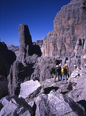
Mountaineering group on the Sentiero delle Bocchette Centrale, in the background the Guglia (Campanile Basso) |
||
| height | 2883 m slm | |
| location | Trentino , Italy | |
| Mountains | Brenta Group | |
| Coordinates | 46 ° 9 '43 " N , 10 ° 53' 38" E | |
|
|
||
| First ascent | August 18, 1899 by Otto Ampferer and Karl Berger | |
| Normal way | Ampferer-Führe climbing route | |
The Campanile Basso ( 2883 m slm ), also often called Guglia di Brenta (ital. "Guglia": needle ), especially in the German-speaking area , is a steep rocky peak of the central Brenta massif . It lies in the connection between comb Cima Brenta Alta ( 2960 m slm ) and Torre di Brenta ( 3014 m slm ), separated by two notches Bocchetta di Campanile Alto in the north and the Bocchetta di Campanile Basso in the south. The Via delle Bocchette Centrali via ferrata crosses the east face and connects the two notches. The Campanile Basso is the most famous climbing peak in the Brenta group. The surrounding huts Rifugio Pedrotti , Rifugio Brentei and Rifugio Alimonta serve as a starting point for an ascent .
Climbs
- Ampferer-Führe ( normal route ), difficulty UIAA V , 270 meters in altitude , (first ascent Otto Ampferer , Karl Berger on August 18, 1899)
- Fehrmann intersection, SW intersection, V-, 350 m ( Oliver Perry-Smith (Seilerster), Rudolf Fehrmann , on August 27, 1908)
- Preußwand , Ostwand, V, 110 m, ( Paul Preuß Free - solo - ascent on July 28, 1911)
literature
- Annette Köhler, Norbert Memmel: Climbing Guide Dolomites . Rother Selection series, Bergverlag Rother , Munich 1993, ISBN 3-7633-3015-1 .
- Stefan Wagenhals & Friends: Dolomites vertical - Band Nord . 3. Edition. Leonberg 2008, ISBN 978-3-934650-07-7 .
Web links
- The conquest of the Campanile Basso (Italian)
- Campanile Basso on summitpost.org (English)

