Cape Floral
| Cape Floral Region Protected Areas | |
|---|---|
|
UNESCO world heritage |
|

|
|
| Table Mountain National Park |
|
| National territory: |
|
| Type: | nature |
| Criteria : | ix, x |
| Surface: | 553,000 ha |
| Reference No .: | 1007 |
| UNESCO region : | Africa |
| History of enrollment | |
| Enrollment: | 2004 (session 28) |
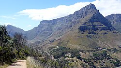
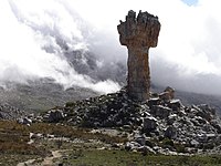
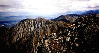
The eight nature reserves in the Cape Floral region are located in the Western Cape and Eastern Cape provinces in South Africa .
They belong since 2004 to UNESCO - World Heritage . The total area of the eight separate protected areas is 553,000 hectares.
The entire Cape flora kingdom ( Capensis ) covers only half a percent of the area of Africa, but with almost a fifth of the plant species of Africa, of which almost a third is endemic, is considered a region with the most diverse flora in the world.
In the vegetation form called fynbos , numerous strategies of reproduction and seed dispersal by birds and insects as well as adaptations to bush fires are found. It is therefore of unique value for research into ecological and biological processes.
Other ecosystems are Renosterveld , Strandveld and Succulent Karoo .

(1) Table Mountain National Park - (2) Wilderness Area Groot Winterhoek - (3) Wilderness Area Zederberge - (4) Boland Mountains - (5) Nature Reserve De Hoop - (6) Wilderness Area Boosmansbos - (7) Swartberge - (8) Baviaanskloof
Components of the world natural heritage
| UNESCO ID | Official name | region | Coordinates | Area in hectares | comment | image |
|---|---|---|---|---|---|---|
| ZA-1007rev | "Protected Areas of the Cape Floral Region" (2004) | |||||
| 1007-001 | Table Mountain National Park | Western cape | 34 ° 10 ′ 0 ″ S , 18 ° 22 ′ 30 ″ E | 17,254.00 |

|
|
| 1007-002 | Wilderness Area Cederberg | Western cape | 32 ° 19 ′ 15 ″ S , 19 ° 7 ′ 0 ″ E | 64,000.00 |

|
|
| 1007-003 | Groot Winterhoek wilderness area | Western cape | 33 ° 5 ′ 30 ″ S , 19 ° 8 ′ 0 ″ E | 26,000.00 |

|
|
| 1007-004 | Boland mountains | Western cape | 33 ° 55 ′ 20 ″ S , 19 ° 9 ′ 50 ″ E | 113,000.00 |

|
|
| 1007-005 | De Hoop nature reserve | Western cape | 34 ° 25 ′ 30 ″ S , 20 ° 29 ′ 30 ″ E | 32,000.00 |

|
|
| 1007-006 | Boosmansbos Wilderness Area | Western cape | 33 ° 55 ′ 30 ″ S , 20 ° 52 ′ 40 ″ E | 15,000.00 |

|
|
| 1007-007 | Swartberg | Western cape | 33 ° 22 ′ 0 ″ S , 22 ° 21 ′ 15 ″ E | 112,000.00 |

|
|
| 1007-008 | Baviaanskloof | Eastern Cape | 33 ° 37 ′ 30 ″ S , 24 ° 1 ′ 0 ″ E | 174,000.00 |

|
|
Web links
- Park Management CapeNature (English)
- Entry on the UNESCO World Heritage Center website ( English and French ).
- Data sheet of the UNEP-WCMC (English)
Individual evidence
- ↑ Cape Floral Region Protected Areas. whc.unesco.org, accessed May 3, 2015 .

