Vredefort crater
| Vredefort crater | |
|---|---|
|
UNESCO world heritage |
|

|
|
| The remains of the Vredefort crater visible from orbit |
|
| National territory: |
|
| Type: | nature |
| Criteria : | viii |
| Surface: | 30,000 ha |
| Reference No .: | 1162 |
| UNESCO region : | Africa |
| History of enrollment | |
| Enrollment: | 2005 (session 29) |
Coordinates: 27 ° 0 ′ S , 27 ° 30 ′ E
The Vredefort Crater (also Vredefort Structure , Vredefort Dome and Vredefort Impact Site ) in the South African province of Free State is the largest safely identified impact crater on earth .
Geographical location
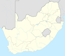
The Vredefort crater is located in the north of the Free State province about 120 km southwest of Johannesburg , about just as far south of the Witwatersrand Mountains and about 75 km (as the crow flies ) west of the Vaal reservoir . It spreads in the Witwatersrand basin near Vredefort .
Description, history, geology
According to various data, the impact of an asteroid , which was probably 10 km in diameter , formed a crater up to 320 km long and 180 km wide with several craters a good two billion years ago (exact dating based on found zirconium crystals : 2023 ± 5 mya ) Wrestling. The impact originally tore a hole 40 km deep and 100 km in diameter in the earth's crust , the walls of which collapsed soon after the impact, leaving behind the above-mentioned crater about 10 km deep. Due to erosion and plate tectonics , only the Vredefort ring with a diameter of around 50 km in the north-western part of the crater is still present today.
In the center of the Vredefort crater is the Vredefort Dome , a dome-like bulge that was initially believed to be of volcanic origin. This was not refuted until the mid-1990s. Numerous finds of impactites and cones of rays testify to the formation of the Vredefort structure by a meteorite impact.
World natural heritage
In 2005, various geological formations in the area of the crater were declared a World Heritage Site by UNESCO . These are:
| UNESCO ID | Official name | region | Coordinates | Area in hectares | comment | image |
|---|---|---|---|---|---|---|
| ZA-1162 | "Vredefort Dome" (2005) | |||||
| 1162-001 | Core area of the Vredefort Dome | Free State , Northwest | 26 ° 52 ′ 0 ″ S , 27 ° 16 ′ 0 ″ E | 30,108.00 | ||
| 1162-002 | Fault with stromatolites | northwest | 26 ° 46 ′ 25 ″ S , 27 ° 16 ′ 12 ″ E | 1.00 | ||
| 1162-003 | Breccia site ( chocolate tablet ) | northwest | 26 ° 55 ′ 12 ″ S , 27 ° 8 ′ 0 ″ E | 1.00 | ||
| 1162-004 | Pseudotachylite quarry | northwest | 26 ° 53 ′ 46 ″ S , 27 ° 24 ′ 30 ″ E | 1.00 |

|
|
literature
- Wolf Uwe Reimold, Roger Lawrence Gibson: Meteorite Impact! The Danger from Space and South Africa's Mega-Impact, the Vredefort Structure . Springer Publishers, Heidelberg-Berlin 2010, ISBN 978-3-642-10464-0 .
Web links
- HartRAO: Visit Deep Impact - The Vredefort Dome . on hartrao.ac.za
- Vredefort in the Earth Impact Database, on passc.net
- The Vredefort Dome - Center of the World's Largest Meteorite Impact Structure , on parys.co.za
- Entry on the UNESCO World Heritage Center website ( English and French ).
Individual evidence
- ^ Vredefort Dome. whc.unesco.org, accessed May 3, 2015 .


