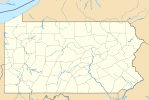
Carnegie, Pennsylvania
| Carnegie | ||
|---|---|---|
 East Main Street in Carnegie |
||
| Location of Carnegie in Pennsylvania | ||
|
|
||
| Basic data | ||
| Foundation : | March 1, 1894 | |
| State : | United States | |
| State : | Pennsylvania | |
| County : | Allegheny County | |
| Coordinates : | 40 ° 24 ′ N , 80 ° 5 ′ W | |
| Time zone : | Eastern ( UTC − 5 / −4 ) | |
| Residents : | 7,972 (as of 2010) | |
| Population density : | 1,944.4 inhabitants per km 2 | |
| Area : | 4.1 km 2 (approx. 2 mi 2 ) of which 4.1 km 2 (approx. 2 mi 2 ) are land |
|
| Height : | 254 m | |
| Postal code : | 15106 | |
| Area code : | +1 412 | |
| FIPS : | 4200311336 | |
| GNIS ID : | 1214778 | |
| Website : | carnegieborough.com | |
 The Husler Building , built in 1896 |
||
Carnegie is a city ( borough ) in Allegheny County , United States . At the 2010 census , the place had 7,972 inhabitants.
geography
The city is located in the greater Pittsburgh area . It is about 8 km southwest of the actual city of Pittsburgh. Chartiers Creek flows through Carnegie . The borough has an area of 4.1 km 2 . The average altitude is 254 m above sea level.
history
The place is named after the industrialist Andrew Carnegie .
Closest places
Web links
Commons : Carnegie, Pennsylvania - collection of pictures, videos, and audio files
Individual evidence
- ↑ Population estimates, July 1, 2015, (V2015). Accessed March 23, 2017 .
- ↑ a b About Carnegie Borough. Accessed March 23, 2017 .
- ↑ Carnegie Borough. Accessed March 23, 2017 .
- ↑ Architectural Drafter Salary in Carnegie, Pennsylvania. Accessed March 23, 2017 .
- ^ Pittsburgh Post-Gazette - Google News archive search. Retrieved March 23, 2017 .
