Carquinez Street
| Carquinez Street | ||
|---|---|---|
| Aerial view of Carquinez Street with the Carquinez Bridge in the foreground and the Benicia – Martinez Bridge in the distance; in the middle the peninsula at Dillon Point with the mast at the location of the first overhead line crossing | ||
| Connects waters | Sacramento-San Joaquin River Delta → Suisun Bay | |
| with water | San Pablo Bay → San Francisco Bay → Golden Gate | |
| Separates land mass | Solano County | |
| of land mass | Contra Costa County | |
| Data | ||
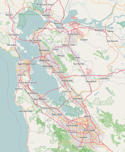
| Geographical location | 38 ° 4 ′ N , 122 ° 13 ′ W | |
|
|
||
| length | 13 km | |
| Smallest width | 800 m | |
| Coastal towns |
Vallejo , Benicia Crockett , Martinez |
|
| bridges | Carquinez Bridge , Benicia – Martinez Bridge | |

The Carquinez Strait is a strait in northern California through which the water from the largest catchment area in California flows through the Golden Gate into the Pacific .
The two largest rivers in California - the Sacramento River and the San Joaquin River - meet in the Sacramento-San Joaquin River Delta and then flow through Suisun Bay into the Carquinez Strait. From here the total current flows over the Bay of San Pablo and the Bay of San Francisco through the Golden Gate into the Pacific Ocean.
Surname
The Spaniards named the strait La Angostura de los Carquines after the Karkin , a tribe of the Muwekma Ohlone who lived around the Bay of San Francisco and south of it .
geography
Carquinez Street is eight miles long and at its narrowest point, at Dillon Point, half a mile wide. In places it is over 30 m deep.
On its north bank is the Solano County with the towns of Vallejo and Benicia , on the south bank is the Contra Costa County with the towns of Crockett and Martinez . Between these locations lies the Carquinez Strait Regional Shoreline, a nature reserve in the East Bay Regional District.
The Carquinez Strait is still in the tidal range . The Carquinez Strait, which is relatively narrow compared to the neighboring bays, has currents with very different directions and speeds that can reach more than 3 knots . On Carquinez Street, the fresh water of the Sacramento and San Joaquin Rivers begins to mix with the salt water of the San Francisco Bay.
bridges
Carquinez Street is crossed by the Carquinez Bridge to the west and the Benicia – Martinez Bridge to the east .
Overhead line crossings
The world's first major overhead line crossing was in 1901 at Dillon Point on Carquinez Street, the overhead line crossing of Carquinez Street .
Two more overhead line crossings were later built immediately west of the Carquinez Bridge.
shipping
Carquinez Strait is used by ocean-going vessels en route to the 10 m deep ports of Sacramento and Stockton via the Sacramento Deep Water Ship Channel and the Stockton Deepwater Shipping Channel, respectively .
In Suisun Bay is Port Chicago, the port of the former Concord Naval Weapons Station of the US Navy , the area of which is partly used by the Military Ocean Terminal Concord .
Forest fire
In 2019, a forest fire skipped Carquinez Strait in strong winds.
Individual evidence
- ^ JG Kohl: Hydrography and history of discovery of the Bay of San Francisco. In: Journal of General Geography. New episode, Volume 4, Berlin, 1858, pp. 293, 320 ( full text in the Google book search)
- ↑ Karkin. In: Survey of California and Other Indian Languages , California Language Archive
- ^ Carquinez Strait Regional Shoreline on ebparks.org
- ↑ As an example: Dillon Point (SFB1320) Depth: 45 feet on tidesandcurrents.noaa.gov
- ↑ Fire In Vallejo Jumps Across Carquinez Strait To Crockett, Shuts Down Bridge. Blog from October 27, 2019 on sfist.com

