Cayoosh Creek
| Cayoosh Creek | ||
| Data | ||
| location | British Columbia ( Canada ) | |
| River system | Fraser River | |
| Drain over | Seton River → Fraser River → Pacific Ocean | |
| Headwaters |
Cayoosh Range ( Pacific Ranges ) 50 ° 23 ′ 16 ″ N , 122 ° 31 ′ 18 ″ W. |
|
| Source height | approx. 2030 m | |
| muzzle | south of Lillooet in the Seton River Coordinates: 50 ° 40 ′ 7 " N , 121 ° 57 ′ 43" W 50 ° 40 ′ 7 " N , 121 ° 57 ′ 43" W |
|
| Mouth height | approx. 200 m | |
| Height difference | approx. 1830 m | |
| Bottom slope | approx. 28 ‰ | |
| length | 66 km | |
| Catchment area | 885 km² | |
| Discharge at gauge 08ME002 A Eo : 885 km² at the mouth |
MQ 2000/2014 Mq 2000/2014 |
7.6 m³ / s 8.6 l / (s km²) |
| Flowing lakes | Duffey Lake | |
| Diverting part of the river water to Seton Lake | ||
|
Duffey Lake |
||
The Cayoosh Creek is a 66 km long right tributary of the Seton River in the Canadian province of British Columbia .
River course
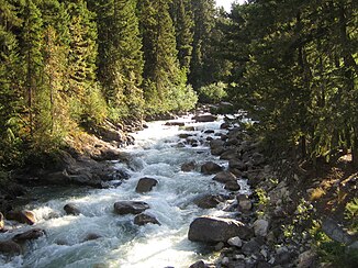
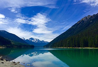
The Cayoosh Creek rises at an altitude of about 2030 m on the southeast slope of the 2561 m high Cayoosh Mountain in the Cayoosh Range , a part of the Pacific Ranges . Cayoosh Creek initially flows in an easterly direction. After 16 km it reaches the western end of Duffey Lake , which it flows through in an easterly direction. Then the Cayoosh Creek turns to the northeast and after another 44 km reaches the Seton River, 3 km above its confluence with the Fraser River . The British Columbia Highway 99 (Duffey Lake Road) runs along the river.
Walden North Hydroelectric Power Station
2.5 km above the mouth there is a dam above Pix Falls on Cayoosh Creek. Most of the river water is directed to the downstream Walden North hydropower station . This was put into operation in 1992. A 250 m long pipe and a 100 m long pressure tunnel feed the water to the power plant. This has 5 Francis turbines with a total output of 16 MW. Below the hydroelectric power station, some of the water is fed to Seton Lake via an underground pipeline . The rest of the water is returned to nearby Cayoosh Creek. How much water goes where depends, among other things, on the season and serves to maintain the salmon migration into Seton Lake and its tributaries. For the last 2.5 km of Cayoosh Creek, the remaining amount of water remains in the river bed. About 700 m above the mouth, the river crosses the Seton Canal by means of a culvert .
Hydrology
The catchment area of Cayoosh Creek covers 885 km². The mean discharge at the mouth is approximately 7.6 m³ / s.
Others
The Seton River was previously considered a tributary of Cayoosh Creek. The Cayoosh Creek Indian Reservation is located at the mouth of the Seton River south of the small town of Lillooet .
Web links
- Cayoosh Creek . In: BC Geographical Names (English)
Individual evidence
- ^ A b c Government of Canada: Historical Hydrometric Data Search Results: Station 08ME002
- ↑ a b c Walden North . Innergex. Retrieved February 23, 2018.
- ↑ a b Seton River Instream Flow Study (PDF, 6.7 MB) Triton Environmental Consultants Ltd. for BC Hydro. January 1996. Retrieved February 23, 2018.
- ↑ Seton River . In: BC Geographical Names (English)

