Celendín
| Celendín | |||
|---|---|---|---|
|
|
|||
| Coordinates | 6 ° 52 ′ S , 78 ° 9 ′ W | ||
| Symbols | |||
|
|||
| Basic data | |||
| Country | Peru | ||
| Cajamarca | |||
| province | Celendín | ||
| ISO 3166-2 | PE-CAJ | ||
| District | Celendín | ||
| height | 2645 m | ||
| Residents | 19,809 (2017) | ||
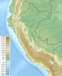
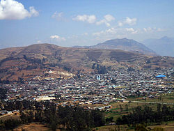
Celendín is a city in northwestern Peru . It is located in the east of the Cajamarca region and is the administrative seat of the Celendín Province and the Celendín District . The city is located 13 km west of the Río Marañón at an altitude of 2645 m . The population was 19,809 in the 2017 census. 10 years earlier it was 16,721.
Individual evidence
- ↑ a b Celendín, province in the Cajamarca region . www.citypopulation.de. Retrieved December 4, 2019.
Web links
Commons : Celendín - collection of images, videos and audio files


