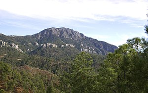
Cerro Mohinora
| Cerro Mohinora | ||
|---|---|---|
|
Cerro Mohinora |
||
| height | 3308 m | |
| location | Chihuahua (State) , Mexico | |
| Mountains | Sierra Madre Occidental | |
| Coordinates | 25 ° 57 '22 " N , 107 ° 2' 52" W | |
|
|
||
| Type | Extinct volcano | |
| rock | Magmatite | |
| particularities | (second) highest mountain in northern Mexico | |
The Cerro Mohinora (or Cerro de Mohinora ) is part of the Sierra Madre Occidental and with its 3308 meters height probably the highest or second highest mountain in northern Mexico . Other mountains in its vicinity (above all Cerro Gordo in the state of Durango ) reach similar heights, but the relevant measurements have not yet been carried out or are still too imprecise.
Emergence
The Cerro Mohinora is of volcanic origin; its origin lies in the Pleistocene . It consists mainly of igneous rock . The last outbreak was probably decades ago.
location
The mountain is located in the wooded south of the state of Chihuahua in the municipality of Guadelupe y Calvo . The borders with the Mexican states of Sinaloa and Durango are only a few kilometers (as the crow flies) away.
climate
The climate in the mountains of northern Mexico is quite rainy; In the morning, it is not uncommon for fog clouds to form, which sometimes make it impossible to enjoy the view of the mountains or the gorges throughout the day. The daytime temperatures are cool in winter, and frosty at night (hotels and accommodations must be heated); in summer, on the other hand, the climate is more pleasant and not nearly as hot and humid as in the lower regions of Mexico.
See also
literature
- J. Andrew McDonald, Jorge Martinez and Guy L. Nesom: Alpine Flora of Cerro Mohinora, Chihuahua, Mexico. In: Journal of the Botanical Research Institute of Texas. Vol. 5, No. 2, 2011, pp. 701-705.

