Champ you feu
| Champ you feu | ||
|---|---|---|
|
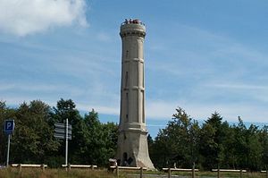
Lookout tower on the Champ du Feu |
||
| height | 1099 m | |
| location | Bas-Rhin department , Grand Est region , France | |
| Mountains | Vosges | |
| Coordinates | 48 ° 23 '40 " N , 7 ° 16' 9" E | |
|
|
||
The Champ du Feu (German Hochfeld ) is a 1099 m high mountain in Alsace in the Vosges in the Bas-Rhin department in the Grand Est region , France . It is located about 10 km southeast of Schirmeck . At the same time, the summit is also a pass .
The Champ du Feu is the highest point in both the Central Vosges and the département. The summit plateau is characterized by extensive heather and moor areas, the vegetation of which has sub-alpine features (including mountain pines ). The 20 m high observation tower was built in 1898 by the Vosges Club , but access is not permitted as it is in a dilapidated state. Because of its good visibility, the mountain is also popular with amateur astronomers . In winter, the Champ du Feu is a much-visited ski area with Le Hohwald as its center .
literature
- P. Elsass, JP von Eller, J [ean] -M [arc] Stussi: Géologie du massif du Champ du Feu et de ses abords. Elements of notice pour la feuille géologique 307 Selestat. Report BRGM / RP-56088-FR. Sélestat 2008.
- M. Kleinhans: L'eau dans l'environnement du massif du Champ du Feu. Thèse de 3e Cycle en Géographie, 2 volumes. Université de Strasbourg II (Marc Bloch): Strasbourg 1988.
- Gontier Ochsenbein: Le Champ-du-Feu. Ses roches et sa végétation. Ses legends et son histoire. Impré: Strasbourg 1965.
- Théo Trautmann: Une promenade botanique au Champ du Feu. In: Les Vosges 2000, No. 1, pp. 12-16 and No. 3, pp. 18-21.
Web links
- Champ du Feu in the Pässelexikon of quaeldich.de ( accessed : March 6, 2009)


