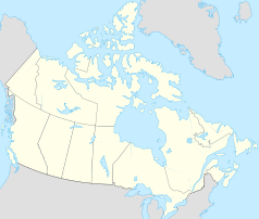
Champagne Landing 10
| Champagne Landing 10 | ||
|---|---|---|
| Location in Yukon | ||
|
|
||
| State : |
|
|
| Territory : | Yukon | |
| Coordinates : | 60 ° 49 ′ N , 136 ° 28 ′ W | |
| Residents : | 24 (as of 2006) | |
Champagne Landing 10 or simply Champagne is a place in the Canadian Yukon and at the same time an Indian reservation . It is located west of Whitehorse on the Dezadeash River and the Alaska Highway .
The reserve's 24 inhabitants (2006) lived in 14 households. They belong to the Champagne and Aishihik First Nations , the majority of whom now live in Haines Junction . In their language, the southern Tutchone , the place is called Shadhäla-Rą ("sunny mountains").
history
In pre-colonial times the Indians of Champagne and Aishihik also lived in Kloo Lake , Klukshu , Canyon, Shäwshe and Hutshi . Their traditional area covered around 29,000 km² in the Yukon and 12,000 km² in British Columbia . This also includes the Tatshenshini-Alsek Provincial Park and part of the Kluane National Park . In 1902, a first trading post was built at this important trading center after a path (the Dalton Trail ) from Whitehorse to Kluane Lake had been built in 1898 . This followed Indian trade paths.
When work began on the Alaska Highway in 1942, which largely followed the trade route established in 1902, thousands of construction workers came to the region. They brought in previously unknown diseases that killed the majority of the population or caused them to flee. The place is one of the hardest hit in the Yukon and looks like a ghost town today. Numerous log cabins in the town a little off the highway, which is only signposted on the highway as a “Place of Interest”, characterize the picture. In 1973 Elijah Smith presented a position paper and presented it to Prime Minister Pierre Trudeau . Negotiations with the government started on the basis of this paper called “Together Today for our Children Tomorrow”. The chief negotiator was Dave Joe of Champagne and Aishihik. In 1993, the tribe, along with three other tribes, signed an initial land use treaty with the governments of Canada and Yukon. The tribe gained possession of 2,427 km² of its traditional territory. He also co-manages the Kluane National Park and is represented on the Alsek Renewable Resources Council , which deals with renewable energies . Since the tribe has legislative power in its area, it was able to enact laws on income tax as well as on traditional hunting and fishing law in 1998 and 1999 .
In 1996 the place had only 8 inhabitants, but their number rose to 20 (2001) and 24 (2006).


