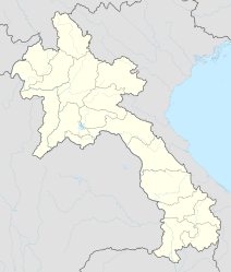
Champasak (city)
|
ຈຳ ປາ ສັກ Champasak |
||
|---|---|---|
|
|
||
| Coordinates | 14 ° 54 ' N , 105 ° 52' E | |
| Basic data | ||
| Country | Laos | |
| Champasak | ||
| District | Champasak | |
| ISO 3166-2 | LA-CH | |
Champasak ( Lao ຈຳ ປາ ສັກ ) is a city in the Lao province of the same name .
history
Already in the 5th century there was a Khmer city with canals and water basins near today's city of Champasak near the temple group Wat Phu . The present city was founded in 1863 as the capital of the Champasak kingdom. The city today has numerous historic colonial-style houses, many temples, a church and an open-air venue where historical films and shadow theater are shown. Wat Phu, a temple on a hill, and the surrounding cultural area of Champasak have been UNESCO World Heritage Sites since 2001 .
traffic
The small town of Champasak is connected by ferries across the Mekong to national road 13 on the left side of the Mekong and thus to Pakse . The city is also connected to the Lao Nippon Friendship Bridge in Pakse via an asphalt road, which opened in 2013, without using the ferry. Wat Phu can be reached from Champasak via an asphalt road.
Individual evidence
- ↑ Vat Phu Champassak World Heritage Department: Vat Phu Champassak. The Temple of the Mountain . 2012, ISBN 978-9932-00062-3 .
- ↑ In the Shadows. In: Oh! magazine. Retrieved January 17, 2017 .
- ↑ UNESCO.de: List of World Heritage
- ↑ Archive link ( Memento of the original dated August 12, 2014 in the Internet Archive ) Info: The archive link was inserted automatically and has not yet been checked. Please check the original and archive link according to the instructions and then remove this notice. - Driving through the editor 07/2014
