
Chang La
| Chang La | |||
|---|---|---|---|
 Chang La with prayer flags |
|||
| Compass direction | southwest | Northeast | |
| Pass height | 5360 m | ||
| Union Territory | Ladakh | ||
| Watershed | → Indus | → Shyok | |
| Valley locations | Tactok | Tangtse | |
| Mountains | Ladakh Range | ||
| Map (Ladakh) | |||
|
|||
| Coordinates | 34 ° 2 '50 " N , 77 ° 55' 50" E | ||

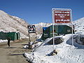
The Chang La is a mountain pass with 5360 m in the Indian Himalayas in the Ladakh region .
It is located in the Ladakh Range ("Ladakh mountain range") and is one of the highest motor vehicle passes in the world. The Chang La connects the Indus Valley in India with the Pangong Tso ( Pangong Lake ), which in turn borders on Tibet. Historically, the Chang La is an important link between Leh and Lhasa . Due to the close Chinese border, the pass is occupied by the military, tourists have to register when crossing the pass.
Chang La Tea Point

Web links
Commons : Chang La - collection of pictures, videos and audio files
Individual evidence
- ↑ Trekking Map Ladakh / Zanskar Center (Leh - Padum - Pangong) 1: 150000, Editions Olizane , ISBN 2-88086-316-3