
Chapala lake
|
Chapala Lake Chapala |
||
|---|---|---|

|
||
| Satellite image of Lake Chapala | ||
| Geographical location | Jalisco , Michoacan ( Mexico ) | |
| Tributaries | Río Lerma | |
| Drain | Río Grande de Santiago | |
| Islands | 3 | |
| Places on the shore | San Luis Soyatlán , Cojumatlán , Chapala , Ajijic , Jamay | |
| Location close to the shore | Ocotlán | |
| Data | ||
| Coordinates | 20 ° 13 ′ N , 103 ° 3 ′ W | |
|
||
| Altitude above sea level | 1520 m | |
| surface | 1 146 km² | |
| length | Max. 79 | |
| width | Max. 28 | |
| volume | 7.897 km³ | |
| Maximum depth | 12 m | |
| Middle deep | 7.5 | |

The Lago de Chapala is the largest natural inland waters of Mexico .
location
Lago de Chapala is located in a high plateau approx. 50 km south of the metropolis of Guadalajara on the border between the states of Jalisco (approx. 86%) and Michoacán (approx. 14%) in western Mexico. The lake has an area of 1146 km², is 1520 m above sea level and is approx. 5–12 m deep.
Rivers and islands
The Río Lerma and numerous smaller streams (when it rains) feed Lake Chapala; its outflow is the Río Grande de Santiago . The lake has 3 small islands; the largest is the approximately 0.5 km² Isla de Mezcala , on which there is a prison surrounded by a moat, but no longer used.
Threat to Lake Chapala
For a long time, Lake Chapala has silted up due to heavy water abstraction (direct line to Guadalajara ), removal of the vegetation in the surrounding mountains and the resulting erosion and sedimentation as well as growth of the aquatic flora or algae caused by uncontrolled introduction of nutrients.
The Río Lerma should supply the lake with around 2 billion m³ of water per year. Inefficient irrigation in agriculture, outdated extraction and transfer methods and also criminal machinations, the lake is losing enormous amounts of water. The city of Guadalajara alone extracts around 240 million m³ annually for drinking water preparation via the Río Santiago.
Fifteen species, including the famous pescado blanco ( Chirostoma compressum ), which belongs to the New World earfish , are no longer present in Lake Chapala and are almost extinct.
Since February 4, 2009, Lake Chapala has been under the protection of the Ramsar Convention . The lake was named " Threatened Lake of the Year " by the Global Nature Fund in 2004 . The lake is also a model project of the international Living Lakes network .
economy
Despite the environmental problems, fish is still caught in Lake Chapala. Tourism plays a not unimportant role, especially for the inhabitants of the city of Guadalajara.
See also
photos

Waterfront in Chapala
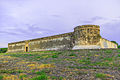
Prison on Isla de Mezcala

View of Chapala

sunset


