Khachintchay
|
Khachintschaj Xacinçay |
||
|
Course of the Khachintschaj ( Chatsjenaget ) |
||
| Data | ||
| location | Nagorno-Karabakh Republic , Azerbaijan | |
| River system | Kura | |
| Drain over | Kura → Caspian Sea | |
| source |
Karabakh Mountains 39 ° 59 ′ 40 ″ N , 46 ° 19 ′ 47 ″ E |
|
| Source height | approx. 2000 m | |
| muzzle |
Kura coordinates: 40 ° 15 '24 " N , 47 ° 27' 54" E 40 ° 15 '24 " N , 47 ° 27' 54" E |
|
| Mouth height | 190 m | |
| Height difference | approx. 1810 m | |
| Bottom slope | approx. 15 ‰ | |
| length | 119 km | |
| Catchment area | 657 km² | |
| Drain |
MQ |
3.2 m³ / s |
| Reservoirs flowed through | Khachin dam | |
| Communities | Vank , Qızıl Kəngərli | |
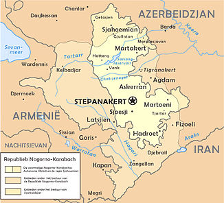
The Chatschintschaj ( Armenian Խաչեն Chat's ; Russian Хачинчай Xaçınçay ) is a right tributary of the Kura in Azerbaijan and the Nagorno-Karabakh Republic .
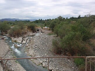
The Khachintschaj rises in the northern part of the Karabakh Mountains . It flows in an easterly direction through the mountains. The Khachintschaj passes, among other things, the village of Vank . When leaving the mountains, it is dammed up by the Khachin dam . The river leaves the Nagorno-Karabakh Republic and flows through the Transcaucasian Depression in an easterly direction. The lower reaches of the Khachintschaj are canalised. It finally flows into the Kura. The Khachintschaj has a length of 119 km. It drains an area of 657 km².

