
Khor Fakkan
Coordinates: 25 ° 20 ' N , 56 ° 21' E


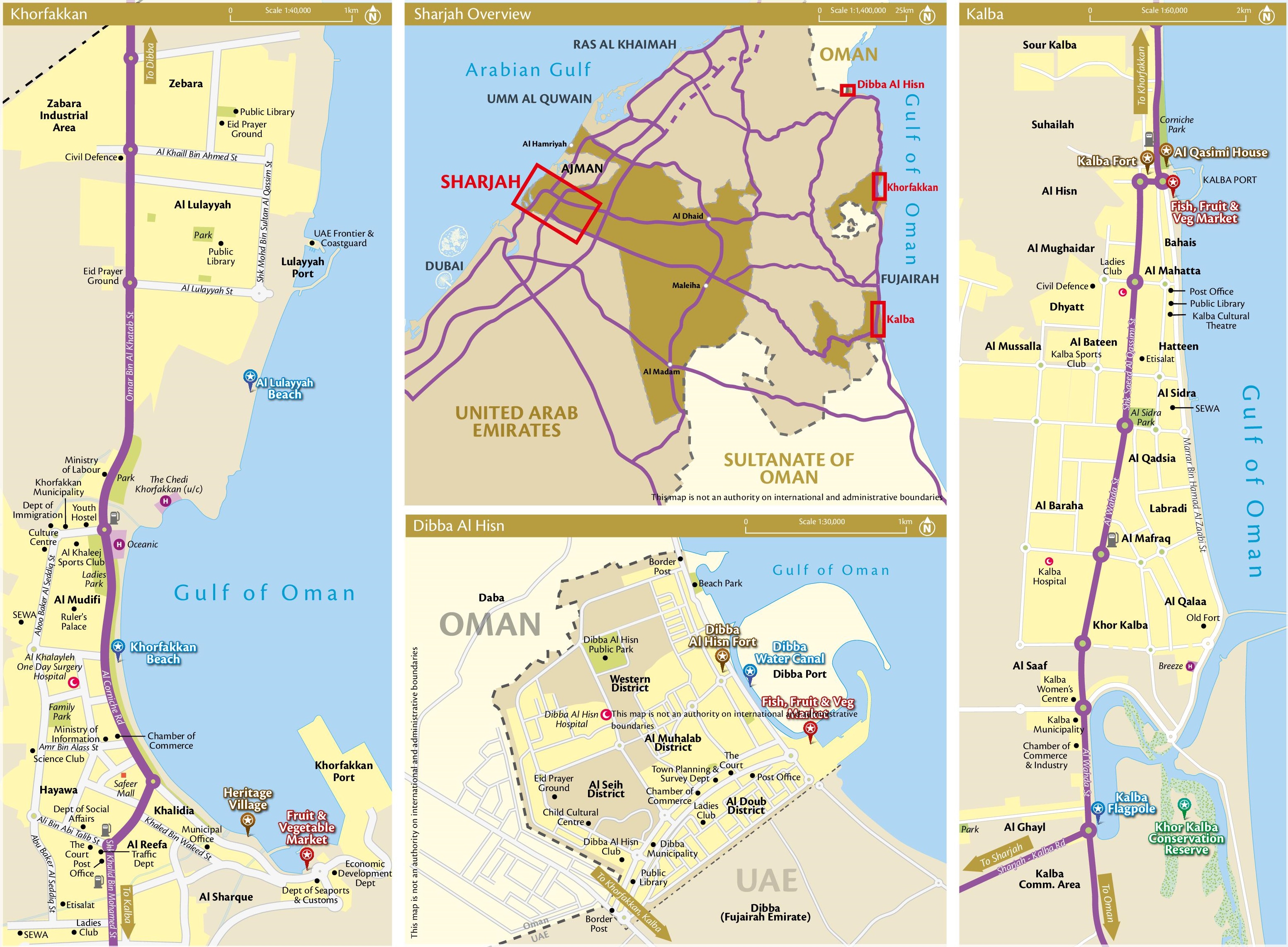
Khor Fakkan ( Arabic خور فكان, DMG Ḫaur Fakkān , also Chaur Fakkan or Chūr Fakkan ) is a city in the United Arab Emirates . It lies on the Gulf of Oman , is surrounded by the Emirate of Fujairah , but belongs to the Emirate of Sharjah as an exclave . The city has an ocean port with a container terminal. Khor Fakkan together with the small inland exclave Nahwa , located around eight kilometers to the south-west, forms the community of the same name, Khor Fakkan.
history
In 1580 the Venetian jeweler Gasparo Balbi mentioned "Chorf" in a list of places on the east coast of what is now the United Arab Emirates, which historians consider to be today's Khor Fakkan.
The Portuguese built a fort there, but it was razed in 1666. In the logbook of the Dutch ship Meerkat, this fort and another under the name Gorfacan are mentioned in connection with a settlement consisting of 200 small wooden huts. The settlement was surrounded by date palms and fig trees, and there were wells in the settlement that were used for irrigation.
In 1737, Khor Fakkan was conquered by the Persians , and from 1765 the city belonged to the sheikh family ruling the emirate of Sharjah. From 1903 to 1952, Khor Fakkan was part of the Emirate of Kalba , which split off from Sharjah during this period , the main part of which is 30 kilometers south, also on the Gulf of Oman.
During the Second World War , the German submarine U 533 was sunk off the coast. The wreck is located 40 km from Khor Fakkan. From 1965 to 1969 the exclave formed an independent postal area and issued stamps with the inscription Sharjah & Dependencies - Khor Fakkan .
Today's meaning
The city gets its current importance mainly from the important seaport, also from tourism . Outside the harbor there are attractive beaches and coral reefs for diving.
City structure
The districts of Khor Fakkan include, from north to south: Zebara, Al Lulayyah, Al Mudifi, Hayawa, Khalidia, Al Reefa, Al Sharque
Web links
Individual evidence
- ↑ VIEW INFOGRAPHICS REPORTS ( Memento of the original dated November 8, 2017 in the Internet Archive ) Info: The archive link was inserted automatically and has not yet been checked. Please check the original and archive link according to the instructions and then remove this notice.
- ^ Michel Übersee Catalog, Volume 10, Middle East 1999. Schwaneberger Verlag, Munich, ISBN 3-87858-752-X
- ↑ OnTheWorldMap: Khor Fakkan (map with designated districts)