Cherry Grove, Minnesota
| Cherry Grove | ||
|---|---|---|
|
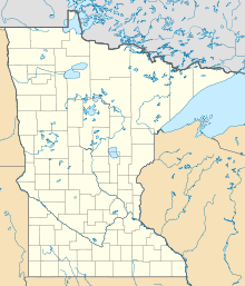
Location in Minnesota
|
||
| Basic data | ||
| State : | United States | |
| State : | Minnesota | |
| County : | Fillmore County | |
| Coordinates : | 43 ° 35 ′ N , 92 ° 17 ′ W | |
| Time zone : | Central ( UTC − 6 / −5 ) | |
| Height : | 404 m | |
| Area code : | +1 507 | |
| FIPS : | 27-11170 | |
| GNIS ID : | 641144 | |
Cherry Grove is a settlement on community-free area ( " Unincorporated Community ") in Fillmore County in the southeast of the US -amerikanischen state of Minnesota .
geography
Cherry Grove is located at 43 ° 35'15 "north latitude and 92 ° 17'20" west longitude and is on the southern edge of Forestville Township .
Neighboring locations to Cherry Grove are Wykoff (14.8 km north), the ghost town of Forestville (17.5 km northeast), Chester , Iowa (17.4 km south), and Spring Valley (19 km northwest).
The nearest major cities are Rochester (67 km north-northwest) and La Crosse , Wisconsin (112 km east). The metropolitan area around the cities of Minneapolis and Saint Paul is 206 km north-northwest.
traffic
There are no national highways through Cherry Grove. The main street of the village is County Road 5. All other roads are partly unpaved roads.
The closest airports are Rochester International Airport (55.8 km northwest) and the larger Minneapolis-Saint Paul International Airport (197 km in the same direction).
Individual evidence
- ↑ Distance information according to Google Maps. Accessed on January 29, 2013
