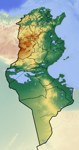
Chott el Fedjadj
| Chott el Fedjadj | ||
|---|---|---|
| Geographical location | in the south of Tunisia | |
| Drain | no | |
| Data | ||
| Coordinates | 33 ° 52 ' N , 9 ° 13' E | |
|
|
||
| Altitude above sea level | 25 m | |
| length | 110 km | |
|
particularities |
Part of the largest salt lake area in the Sahara |
|
The Chott el Fedjadj (also Chott el Fejej and Schott Fedjedj ; Arabic شط الفجاج, DMG Šaṭṭ al-Fiǧāǧ ) is a sedimentary basin within a depression with a salt lake in southern Tunisia .
geography
Together with its continuation in the west, Chott el Djerid , and the further west lying Chott el Gharsa , the depression has an area of 7,700 km² and a west-east extension of approx. 200 km from the Algerian border to almost the Mediterranean . The greatest width of the region is around 70 kilometers. This makes it the largest salt lake area in the Sahara .
In ancient times, the area was Tritonis ( Tritonis Lacus or Tritonis Palus ) after the river Triton , the lake or marsh fed, and later Salinarum Lacus called ( "salt lake"). However, the geographic allocation is not entirely certain.
The surface of the Chott el Fedjadj is 25 m; the lake is 110 km long (in west-east direction) but never becomes wider than 32 km. At the eastern end, near the town of El Hamma , the Mediterranean Sea is only 21 km away. Chott el Gharsa to the west is below sea level. The depression, which extends into Algeria, deepens in a westerly direction and sinks in the local Chott Melghir to −26 m.
Due to the extreme climatic conditions (annual precipitation 100 mm, maximum temperatures up to 50 ° C) the water evaporates and the salts crystallize to a dry crust, under which there is deep silt. In the summer the chott dries out almost completely and becomes a salt flat .
After rains in winter and spring, large parts of the chott are flooded or silted up. Especially in summer, mirages ( mirages ) occur when the sun is high .
South of the salt lake is the oasis area Nefzaoua with the main towns Kebili and Douz . Road RR 103 or C 103 crosses the salt lake in a north-south direction.
At the end of the 19th century there were plans to connect the Chott el Fedjadj and the Chott el Djerid with the sea by a canal and thus create a huge lake. However, the plan failed because the surface of the Chott turned out to be above sea level.
