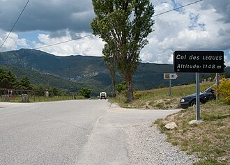
Col des Lèques
| Col des Lèques | |||
|---|---|---|---|
|
|
|||
| Compass direction | west | east | |
| Pass height | 1148 m | ||
| Department | Alpes-de-Haute-Provence | ||
| Watershed | Aces | Verdon | |
| Valley locations | Senez | Castellane | |
| Mountains | Provencal Alps and Pre-Alps | ||
| profile | |||
| Mountain scoring | 3 | ||
| Ø pitch | 5.1% (336 m / 6.6 km) | 4.7% (423 m / 9 km) | |
| Max. Incline | 8.6% | 8.4% | |
| Map (Alpes-de-Haute-Provence) | |||
|
|
|||
| Coordinates | 43 ° 51 '56 " N , 6 ° 27' 50" E | ||
The Col des Lèques is a mountain pass in the French department of Alpes-de-Haute-Provence . It has a top height of 1148 m and is located on Route nationale 85, which is known as the " Route Napoléon " between Castellane and Barrême .
Web links
Commons : Col des Lèques - Collection of images, videos and audio files

