Col du Portillon
| Col du Portillon Coll del Portillón |
|||
|---|---|---|---|
|
Road in winter |
|||
| Compass direction | west | east | |
| Pass height | 1293 m | ||
| region | Haute-Garonne , Occitania , France | Lleida , Catalonia , Spain | |
| Valley locations | Bagneres-de-Luchon | Bossòst | |
| Mountains | Pyrenees | ||
| profile | |||
| Ø pitch | 7.2% (655 m / 9.1 km) | 6.9% (568 m / 8.2 km) | |
| Max. Incline | 12.4% | 11.3% | |
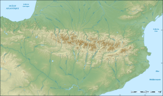
| map | |||
|
|
|||
| Coordinates | 42 ° 46 '9 " N , 0 ° 39' 36" E | ||
The Col du Portillon or Coll del Portillón is a mountain pass in the Pyrenees between France and Spain . It has already been crossed in the Tour de France and the Vuelta a España .
Individual evidence
- ^ Col du Portillon / Coll del Portillón. In: cyclingcols.com. Retrieved July 7, 2018 .

