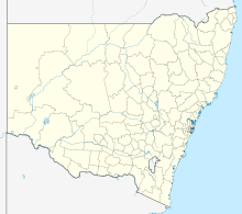
Coonamble
| Coonamble | |||||
|---|---|---|---|---|---|
 Main road |
|||||
|
|||||
|
|||||
|
|||||
|
|||||
|
|
|||||
Coonamble is the main town of the Coonamble Shire in New South Wales in Australia . The agricultural small town is located northwest of Gilgandra on the Castlereagh Highway . In addition to a local museum, there is a 50 m pond.
economy
The place is characterized by agriculture ( wheat cultivation and sheep breeding ). A rodeo with 4,000 visitors is also held annually.
Individual evidence
- ↑ Australian Bureau of Statistics : Coonamble ( English ) In: 2016 Census QuickStats . June 27, 2017. Retrieved January 26, 2020.
