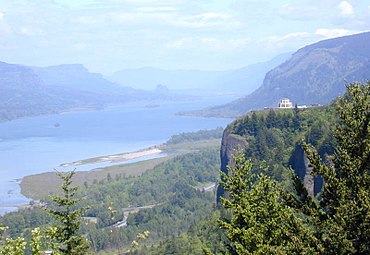
Vista House
Vista House is a historic rest house located at a lookout point known as Crown Point on the Historic Columbia River Highway . It is located high above the western end of the canyon Columbia River Gorge in the transverse valley of the Columbia River through the Cascade Range and now forms the core of the 124-hectare state park Crown Point State Scenic Corridor in Multnomah County , Oregon .
history
When the Columbia River Highway was built as the first upgraded road along the gorge at the beginning of the 20th century , construction manager Samuel Lancaster realized that the 225-meter cliff, originally called Thor's Heights , would be an ideal location for a lookout point and rest area. In 1916 the construction of the Vista House on the top of the mountain, financed exclusively from donations, began according to a design by the architect Edgar M. Lazarus in the style of the "modern German architecture" of the time, Art Nouveau . The building was inaugurated on May 5, 1918 as a resting place and in memory of the pioneers of Oregon. In 1938, Multnomah County and the City of Portland gave the building to the State of Oregon, which classified it as a state park. It has been on the National Register of Historic Places since 1974 . The non-profit organization Friends of the Vista House has been supporting the maintenance and use of the building since 1987 . After only the toilets of the building were accessible for years, it was extensively restored in 2005 and reopened.
investment
The octagonal building, clad on the outside with dark sandstone, has a diameter of 13 meters. Its dome, covered with green tiles, is almost 17 meters high. The interior is decorated with token marble from Alaska and various wood paneling with carvings depicting the history of Oregon. It now houses a museum with an exhibition of landmarks in the Columbia River Gorge, a gift shop, and a coffee shop.
The overlook and State Scenic Corridor provide hiking and walking trails at the top of the gorge with panoramic views of Columbia River Gorge to Beacon Rock . At the foot of the cliff is Rooster Rock State Park .
Crown Point
Crown Point is located on a 225 m high rock made of Wanapum basalt and comes from a lava flow flowing about 14 million years ago that filled a prehistoric river valley of the Columbia River . The ice-age Missoula floods , which even washed over the top of the rock, eroded softer rock layers, so that the rock now appears as a steep cliff. The cliff was originally named Thor's Heights and was recognized as a National Natural Landmark in 1971 .
literature
- Jan Bannan: Oregon State Parks: A complete Recreation Guide. Mountaineers Books, Seattle 2002, ISBN 978-0-89886-794-7 .
Web links
- Oregon State Parks: Crown Point State Scenic Corridor
- Oregon State Parks: Information brochure about Crown Point and Vista House (PDF; 241 kB)
- Friends of Vista House: website
Individual evidence
- ^ Crown Point in the Geographic Names Information System of the United States Geological Survey
- ↑ USGS: Glacial Lake Missoula and the Missoula Floods. Retrieved September 30, 2011 .
Coordinates: 45 ° 32 '22 " N , 122 ° 14' 39" W.


