Cuilápam de Guerrero
| Cuilápam de Guerrero | ||
|---|---|---|
|
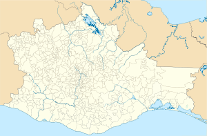
Coordinates: 17 ° 0 ′ N , 96 ° 47 ′ W Cuilápam de Guerrero on the map of Oaxaca
|
||
| Basic data | ||
| Country | Mexico | |
| State | Oaxaca | |
| Municipio | Cuilápam de Guerrero | |
| Residents | 12,360 (2010) | |
| Detailed data | ||
| surface | 50 km 2 | |
| Population density | 247 inhabitants / km 2 | |
| height | 1565 m | |
| Time zone | UTC −6 | |
| former Dominican monastery of Santiago Apóstol | ||
Cuilápam de Guerrero ( Cuilápam or Cuilapan for short ) is a city of approx. 13,000 and the seat of the municipality of the same name ( municipio ) with a total of approx. 19,000 inhabitants in the center of the Mexican state of Oaxaca .
location
Cuilápam is located about 12 km (driving distance) southwest of Oaxaca , the capital of the state of the same name at an altitude of about 1565 m .; as far as Mexico City is about 475 km to the northwest. The climate is mostly hot and dry; Rain (approx. 700 mm / year) falls almost exclusively in the summer months.
Population and economy
The population consists mainly of Zapotec and Mixtec ; Colloquial language is also Spanish. Corn, beans, vegetables, agaves and opuntia are grown in the fields; In the small town itself there are many small craft businesses and shops as well as various service facilities for banking, school and health care.
history
Human traces in the Oaxaca Valley are about 10,000 years old; the Zapotecs dominated the region from around 1500 BC. After the decline of Monte Alban (approx. 900 AD), they faced competition from the Mixtecs who immigrated from the north. Both peoples were subjugated and made tribute by the Aztecs in 1458 . Following the conquest of the Aztec Empire by the Spanish conquistadors under Hernán Cortés (1519–1521), he also conquered the Oaxaca Valley. A few years later, the Spaniards sent monks and missionaries to the newly won overseas colonies, who immediately began to delimit areas of influence and establish religious settlements; the Dominican order took responsibility for the area of Cuilápam . After achieving Mexican independence, Cuilapám was given parish status in 1831; In January of the same year, the ex-President Vicente Guerrero was arrested here at the instigation of his adversary, General Anastasio Bustamante , and shot dead on February 14th.
Attractions

- The main attraction of the place is the seemingly unfinished building of the open chapel ( Capilla abierta ) of the Dominican monastery of Santiago Apóstol , which is located a little outside , the gable facade of which is framed by two lateral round towers . The roofless three-aisled building with its arcaded side walls and two inner rows of columns was started in the 1550s; however, work on the monastery had to be stopped around 1570 for reasons of cost or because it no longer corresponded to the original idea of the simplicity of the building. In addition, the Indian population was decimated from about 43,000 in 1521 to only 6,000 as a result of fighting, disease, food shortages and emigration; so there may not have been enough workers available for construction. In 1753 the leadership of the monastery passed from the Dominican order to secular priests.
- In the actual monastery complex converted into a museum, the two-story cloister ( claustro ) is particularly interesting.
- Nearby is a memorial commemorating the shooting of Vicente Guerrero.
Surroundings
- The pre-Hispanic cult site of Zaachila, which is well worth seeing, is only approx. 6 km to the south-east.

