Culm (Brahmenau)
|
Culm
community Brahmenau
Coordinates: 50 ° 55 ′ 21 ″ N , 12 ° 9 ′ 26 ″ E
|
||
|---|---|---|
| Height : | 225-250 m | |
| Incorporation : | 1938 | |
| Postal code : | 07554 | |
| Area code : | 036695 | |
|
Location of Culm in Thuringia |
||
|
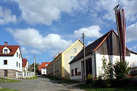
View of the town with the fire department on the right edge of the picture
|
||
Culm is a district of Brahmenau in the Greiz district in Thuringia .
location
Today Culm is located in the local area of Brahmenau (northeast of Gera ) at a turnoff of the state road L 1079, again called “Bramenau”. Geographically, Culm is on the southern edge of the Leipzig lowland bay .
history
The settlement area, which around 1900 only consisted of a brickworks and a homestead, was given a breakpoint on the former railway line from Gera to Meuselwitz in order to be able to transport fuel and brickwork products inexpensively. Today the railway site has been demolished, the brickworks replaced by an industrial park and the entire corridor has been built over with Brahme's single-family houses. On October 1, 1922, Waaswitz was incorporated into Culm, followed by Groitschen on October 1, 1937 . On November 13, 1937, the Culm parish was renamed Brahmenau . On July 1, 1950, Zschippach was finally incorporated. The street name Culmer Weg reminds of the former place.

