Curanilahue
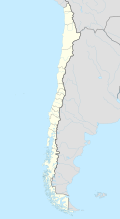
Curanilahue is a city in the south of the South American Andean state of Chile .
Geography and climate
Curanilahue is located around 39 km south of Arauco and around 40 km north of Cañete in the Región del Bío-Bío .
The city is located on the Río Curanilahue and has around 30,000 inhabitants (2004). The city is best known for its hard coal mining .
The mean annual temperature is 12 ° C.
history
The area around Curanilahue was a heavily contested area between the Mapuche and the Spaniards around 1550 . Francisco de Villagra tried in 1554 to advance from Concepción to the southern areas. On February 23, 1554 there was the battle of Marigüeñu with the leader ( Toqui ) of the Mapuche Lautaro . Villagra was ambushed and had to escape from the clutches. The Mapuche then began massive attacks on the fortresses of the Spaniards. Many cities were completely destroyed.
On July 2, 1852, the province of Arauco was established. The area around Curanilahue belonged to the Lebu Department . On March 4, 1881, the area on the Río Curanilahue was redistributed by decree . This can be seen as the birth of Curanilahue. Curanilahue Commune was officially established on May 23, 1913.
Coal mining
Coal mining in the province of Arauco began around 1850. The main focus of mining is in the cities of Lota and Coronel . This is followed by Curanilahue and Peumo . The two cities produce around 150,000 tons of hard coal per year.
tourism
The coal mining is certainly the most interesting tourist destination in Curanilahue, but the surrounding area also offers a number of wonderful landscapes for excursions.
Web links
Coordinates: 37 ° 29 ′ S , 73 ° 21 ′ W
