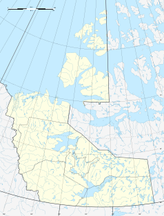
Déline
| Déline | ||
|---|---|---|
 |
||
| Location in Canada | ||
|
|
||
| State : |
|
|
| Territory : | Northwest Territories | |
| Coordinates : | 65 ° 11 ′ N , 123 ° 26 ′ W | |
| Area : | 79.44 km² | |
| Residents : | 533 (as of 2016) | |
| Population density : | 6.7 inhabitants / km² | |
| Time zone : | Mountain Time ( UTC − 7 ) | |
| Postal code : | X0E 0G0 | |
| Area code : | +1 867 | |
| Foundation : | April 1, 1993 ( incorporated ) | |
| Mayor : | Leeroy Andre | |
| Website : | www.deline.ca | |
 Déline at the Great Bear Lake |
||
Déline (pronounced De-la-nay) is a settlement on the banks of the Keith Arm of the Great Bear Lake ( Sahtú - "Bear Lake" called) in the Northwest Territories of Canada . Until 1993 it was called Fort Franklin . The present name in the language of the North Slavey (Sahtu Dene) and "Where the water flows" of refers to the upper reaches: Great Bear River (Engl. Great Bear River , hours of. Sahtu De at the same time, - "Bear River") as the outflow of the Keith Arm (which forms the southwest of the Great Bear Lake) into the Mackenzie River. Déline is 544 km northwest of the city of Yellowknife .
Déline has around 550 inhabitants, mainly North Slavey ( Sahtugotine or Bear Lake Dene ), who together with the South Slavey ( Deh Cho ) form the Slavey .
The region became famous when pitchblende was discovered in the Eldorado mine, about 250 km from Déline . During the Second World War , the Canadian government took over the mine and began uranium production for the then secret US - nuclear bomb program . The former village of Fort Franklin became a permanent settlement in 1952 when a school was built.
The Sahtú Dene from Déline employed in the ore transport were neither informed of the dangers of radioactivity nor of protective measures. Many of the men from the village have died since the 1960 years of cancer .
Immediately north of the community is the local airport ( IATA airport code : YWJ, ICAO code : CYWJ, Transport Canada Identifier: -) with a 1,199 meter long and graveled runway. In order to be able to maintain the airport of the settlement, the residents are dependent on kerosene transport over the ice road of Yellowknife. In this context, the series Ice Road Truckers also takes place in this settlement.
The public school is named after ɂehtsǝ́o Erǝ́ya, known as the prophet.
Web links
Individual evidence
- ^ Census Profile, 2016 Census. Déline, Chartered community. In: Statistics Canada . August 9, 2019, accessed September 16, 2019 .
- ↑ Airport diagram. (PDF; 76.9 MB) In: NAV CANADA . Retrieved September 16, 2019 .

