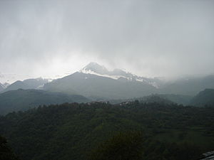
Dešat
| Dešat | ||
|---|---|---|
|
West side of the mountain with Velivar on the left and Kërçina on the right |
||
| height | 2375 m | |
| location | Albania , North Macedonia | |
| Mountains | Korab Mountains | |
| Coordinates | 41 ° 37 '48 " N , 20 ° 32' 24" E | |
|
|
||
|
The DESAT from Saint Jovan Bigorski Monastery seen from |
||
The Dešat or Albanian Deshat ( Macedonian Дешат ) is a mountain on the border between Albania and North Macedonia . The mountain is characterized by its steep peaks.
The highest peak is the Velivar ( 2375 m. I. J .; Macedonian Веливар ). The second highest point of the mountain is the summit Kërçina ( 2345 m. I. J .; Macedonian Крчин Krčin ). Other significant elevations are Deli Senica ( 2258 m above sea level ) and Suva Bara ( 2140 m above sea level ). The mountain range stretches like the entire Korab Mountains , the southern end of which it forms, in a north-south direction between the Black Drin and its tributary Radika . In the south, the Dešat drops steeply to the Macedonian city of Debar and Lake Debar . The next town on the Albanian side is Peshkopi ; at the foot of Velivar and Kërçina is the place Maqellara .
The Dešat has deep gorges, large forests and glacial lakes.
Web links
Individual evidence
- ↑ Pandi Geco: Shqipëria: pamje fiziko-ekonomike. Text për Faculty e histori-filologijsë dhe Faculty of Economics. Mihal Duri 1959, OCLC 28127519 , p. 14 ( limited preview in Google Book search).
- ↑ Perikli Qiriazi: Gjeografia fizike e Shqipërisë . New edition edition. Shtëpia botuese e librit universitar, Tirana 2006, ISBN 99927-0-397-0 , p. 189 .


