Dedo de Deus
| Dedo de Deus | ||
|---|---|---|
| height | 1692 m | |
| location | Rio de Janeiro , Brazil | |
| Mountains | Serra dos Órgãos , Serra do Mar | |
| Coordinates | 22 ° 30 ′ 0 ″ S , 43 ° 3 ′ 0 ″ W | |
|
|
||
| First ascent | April 1912 | |
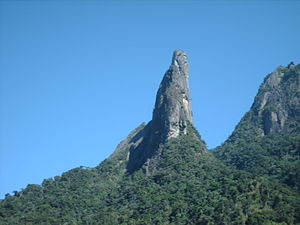
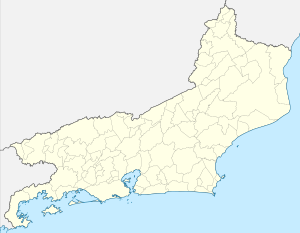
The Dedo de Deus , finger of God , is a 1692 meter high mountain in the Brazilian mountain range Serra dos Órgãos , part of the Serra do Mar , in the state of Rio de Janeiro , between the cities of Petrópolis , Guapimirim and Teresópolis .
Position and shape
The mountain lies on the border of the Serra dos Órgãos National Park in the area of the municipality of Guapimirim. Its shape is reminiscent of a hand whose index finger points towards the sky. The best way to see it is from the vantage point Mirante do Soberbo on the national highway BR-116 at the entrance Teresópolis.
First ascent
The Dedo de Deus was established in April 1912 by Raul de Sá Carneiro, José Teixeira Guimarães and the brothers Acácio and Alexandre Oliveira Américo first climbed . Since then, it has been an important attraction for mountaineers in Brazil.
Coat of arms and flag symbol
The distinctive silhouette of Dedo de Deus also found its way into heraldry , for example in the shield of the coat of arms and thus also in the flag of the state of Rio de Janeiro , as well as in those of Guapimirim and Magé .
See also
Web links
- "A emoção da escalada do Dedo de Deus após 90 anos da primeira conquista"
- O Dedo de Deus on AltaMontanha.com


