Degernbach (Bogenbach)
| Degernbach | ||
|
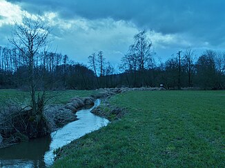
Degernbach before it flows into the Bogenbach |
||
| Data | ||
| Water code | DE : 15886 | |
| location | District of Straubing-Bogen | |
| River system | Danube | |
| Drain over | Bogenbach → Danube → Black Sea | |
| confluence | in Degernbach (Bogen) in arc 48 ° 54 ′ 52 ″ N , 12 ° 45 ′ 52 ″ E |
|
| Source height | 328 m | |
| muzzle | in the Degernbach near Degernbach , City of Bogen Coordinates: 48 ° 54 '35 " N , 12 ° 44' 23" E 48 ° 54 '35 " N , 12 ° 44' 23" E |
|
| Mouth height | about 320 m | |
| Height difference | about 8 m | |
| Bottom slope | about 3.6 ‰ | |
| length | 2.2 km | |
| Right tributaries | Heubach | |
| Small towns | arc | |
The Degernbach is a left tributary of the Bogenbach in the district of Straubing-Bogen , Lower Bavaria .
It begins at the confluence of Weinbergbach and Waidbach in Degernbach . The first six hundred meters it runs westwards, then it swings to the southwest at the mouth of the Heubach and crosses under the federal motorway 3 . After another six hundred meters, there is another change of direction to the west to the confluence with the Bogenbach. The course of the Degernbach only touches the area of the town of Bogen in the districts of Degernbach and Bogenberg.
Earlier names
In the measuring table from 1949 and the following, the stream in the first section, from the confluence of the Waidbach and Weinbergbach to the mouth of the Heubach, is referred to as the Bäckerwiesgraben . The following section is called Sandhofbachl there . The name Degernb appears for the first time with the map from 1967 . on.
Web links
Individual evidence
- ↑ a b BayernAtlas of the Bavarian State Government ( notes )
- ↑ Directory of creek and river areas in Bavaria - Naab to Isar river area, page 115 of the Bavarian State Office for the Environment, as of 2016 (PDF; 2.8 MB)
- ↑ Bavarian State Surveying Office (Ed.): Topographische Karte 7042 Bogen . Munich 1949 ( online PDF, 9.3 MB).
- ↑ Bavarian State Surveying Office (Ed.): Topographische Karte 7042 Bogen . Munich 1967 ( online PDF, 9.5 MB).
