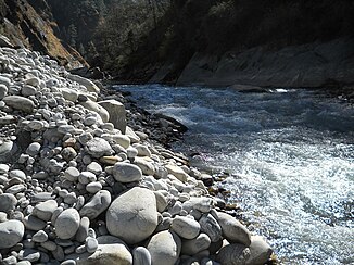
Dhauliganga
| Dhauliganga | ||
| Data | ||
| location | Uttarakhand ( India ) | |
| River system | Ganges | |
| Drain over | Alaknanda → Ganges → Indian Ocean | |
| origin |
Raikanagletscher 30 ° 53 '57 " N , 79 ° 45' 27" O |
|
| Source height | approx. 4700 m | |
| muzzle |
Alaknanda near Vishnuprayag Coordinates: 30 ° 33 '45 " N , 79 ° 34' 32" E 30 ° 33 '45 " N , 79 ° 34' 32" E |
|
| Mouth height | approx. 1400 m | |
| Height difference | approx. 3300 m | |
| Bottom slope | approx. 40 ‰ | |
| length | 82 km | |
| Left tributaries | Rishiganga | |
| Small towns | Jyotirmath | |
| Communities | Niti, Raini, Vishnuprayag | |
|
The Dhauliganga flows into the Alaknanda (right) |
||
The Dhauliganga is a left tributary of the Alaknanda , the left source river of the Ganges , in the Himalayas in the Indian state of Uttarakhand .
The Dhauliganga arises on the Raikana glacier at an altitude of 4700 m . The Dhauliganga flows mainly in a southerly direction through the Chamoli district and turns west for the last 20 km. The river valley separates the Kamet group in the west from the Nanda Devi group in the east. At Rani , the Dhauliganga takes the Rishiganga from the left. The small town of Jyotirmath lies on the river bank just before the estuary . The Dhauliganga finally flows into the Alaknanda at Vishnuprayag . The Dhauliganga has a length of 82 km.
Web links
Commons : Dhauliganga - collection of images, videos and audio files

