Dirk Hartog Island
| Dirk Hartog Island | ||
|---|---|---|
| Map of Shark Bay on which Dirk Hartog Island can also be seen | ||
| Waters | Indian Ocean | |
| Geographical location | 25 ° 49 ′ S , 113 ° 5 ′ E | |
|
|
||
| length | 79.6 km | |
| width | 11.3 km | |
| surface | 620 km² | |
| Highest elevation | Herald Heights 136 m |
|
| main place | Dirk Hartog Homestead | |
| Shark Bay satellite image | ||
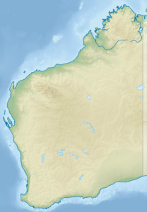
Dirk Hartog Island ( called Wirruwana in the local Aboriginal language ) is an island in the Shark Bay area on the west coast of Australia .
The island is around 80 kilometers long and between 3 and 11 kilometers wide. It is the longest and most westerly island in Western Australia, about 850 km north of Perth in the state of Western Australia . On the west coast, the island reaches its highest height at 185 meters in the Herald Heights. The Dirk Hartog Homestead is located on the east coast facing the mainland. The 1.6 km wide South Passage separates the island from the Edel Land peninsula in the south.
The Dutch navigator Dirk Hartog set foot on Australian soil for the first time on October 25, 1616 . He was the second European in Australia.
The island is uninhabited and has only been officially accessible via the Western Australian city of Denham for ten years . It belongs to the Shire of Shark Bay political parish . A small part of the island is leased to Kieran and Tory Wardle.
Flora and fauna
The island is characterized by sand dunes with bushes. In the past it was used for sheep grazing, up to 20,000 sheep grazed here, now the sheep have been completely removed. The area around the island has the largest seagrass in the world, which is why dolphins , sharks , manatees and other sea creatures like to stay in the bay. Over ten percent of the world's manatee population can be found here. Dirk Hartog Iceland belongs since 1991 to UNESCO - World Heritage . The island has now been designated as the Dirk Hartog Island National Park . It is connected to the Shark Bay Marine Park to the east and is part of the Shark Bay World Heritage Area . A small part of the island is marketed for tourism.
The beaches of Dirk Hartog are an important egg-laying place for the loggerhead turtle and the green sea turtle . The island is also a breeding ground for the endemic subspecies of the white-winged easel tail . Quoin Bluff on the east coast of the island is a significant breeding colony of the magpie shag . Together with Freycinet Island, it is part of an Important Bird Area .
Feral cats are a problem for nature conservation. A project of the Department of Parks and Wildlife is trying to remove the cats from the island with the help of wildlife cameras and trained dogs.
Web links
Individual evidence
- ↑ Department of Parks and Wildlife 2013-14 Annual Report (PDF), p. 31 on parliament.wa.gov.au. Retrieved August 16, 2017
- ↑ Sailing Directions Vol. 175, p. 115
- ^ BirdLife International. (2011). Important Bird Areas factsheet: Quoin Bluff and Freycinet Island (Shark Bay). Download from http://www.birdlife.org on 25/09/2011
- ^ Eradicating feral cats from Hartog Island ( Memento from November 13, 2016 in the Internet Archive )
- ↑ taz article: environmental robber cat


