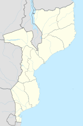
Dondo (Mozambique)
| Dondo | ||
|---|---|---|
|
|
||
| Coordinates | 19 ° 37 ′ S , 34 ° 45 ′ E | |
| Basic data | ||
| Country | Mozambique | |
| Sofala | ||
| ISO 3166-2 | MZ-S | |
| surface | 382 km² | |
| Residents | 78,639 (2009) | |
| density | 205.9 Ew. / km² | |
| politics | ||
| President of the City Council | Manuel Cambezo | |
Dondo is a city in Mozambique in the Sofala province .
geography
Dondo is a good 20 kilometers north-northwest of the provincial capital Beira , and the Pungwe flows about 10 kilometers west of the city . Since 1998, Dondo has been a municipality with an area of 382,382 square kilometers. It is also the administrative seat of the district .
population
According to an estimate, the city had 78,639 inhabitants in 2009. As early as 1997 there were 71,644 people, but the population fell to an estimated 61,000 in 2003.
history
On July 24, 1986, Dondo received city rights.
politics
The President of the City Council (Conselho Municipal) is Manuel Cambezo (as of 2009, 2012).
Economy and Infrastructure
In Dondo is the cement plant of Cimentos de Mozambique , the limestone from Muanza used. One of Mozambique's two railway sleeper factories is also located here . The other is further north in Vila de Sena .
Dondo has a train station. Here the route to Malawi and Moatize meets the route to Zimbabwe .
Individual evidence
- ^ World Gazetteer: Dondo
- ^ Nestlé: Nestlé Mozambique provides hope to local people of Dondo , November 24, 2012
- ↑ Global Cement Plant Database: Cimentos de Mozambique, SARL - Dondo
- ↑ Bloomberg Businessweek: Cimpor Investing 15 Million Euros in Dondo, Mozambique Plant , September 19, 2011
