Drino
|
Drino Δρίνος, Drino, Drin, Fitóki |
||
|
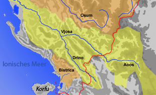
Map of southern Albania |
||
| Data | ||
| location | Greece , Albania | |
| River system | Vjosa | |
| Drain over | Vjosa → Mediterranean | |
| muzzle | at Tepelena coordinates: 40 ° 17 ′ 13 ″ N , 20 ° 2 ′ 31 ″ E 40 ° 17 ′ 13 ″ N , 20 ° 2 ′ 31 ″ E
|
|
| length | 84.6 km | |
| Catchment area | 1324 km² | |
| Drain |
MQ |
41.6 m³ / s |
| Small towns | Gjirokastra | |
|
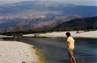
The river at Ujë i ftohtë just before the mouth |
||
|
Drino near Gjirokastra |
||
|
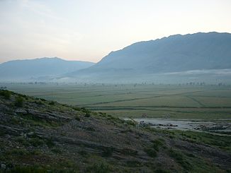
Dropull level at Jorgucat |
||
The Drino ( Greek Δρίνος , Albanian rarely Drin ) is a river in the southeastern European region of Epirus . Its 84.6-kilometer run is directed from the southeast to the northwest. The source is in northern Greece . After about 20 kilometers, the Drino crosses into Albanian territory. At Tepelena it flows into the Vjosa . The upper course is called Fitóki and leads through remote mountainous country northwest of Ioannina along the Greek-Albanian border. The strip drained by the Drino extends barely more than ten kilometers into Greek territory. A little south of the Greek-Albanian border crossing Kalpaki / Kakavija , the European route 853 crosses the Drino with a bridge.
Immediately at the border, the valley widens. A plain several kilometers wide extends to Gjirokastra . This level is called the dropull . The valley is still surrounded by high mountains : in the west the Mali i Gjerë chain , in the east the Lunxhëria- Buretoja mountain range . The villages are located on the edge of the valley or even on the mountain slopes such as Libohova , ancient Antigoneia and the historic center of Gjirokastra.
North of Gjirokastra the valley narrows noticeably again. At the end of the Dropull plain, the mountain stream Përroi i Kardhiqit flows from the west into the Drino, which, in contrast to the large river, carries water all year round. From here on the Drino winds again through a narrow valley. South of Tepelena it flows into the Vjosa , of which it is the most important tributary.
The Drino drains an area of 1324 square kilometers. The average flow rate is 41.6 m³ / s.


