Drusberg
| Drusberg | ||
|---|---|---|
|
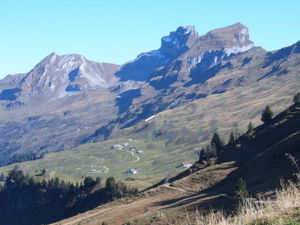
Druesberg with Twäriberg ( 2117 m , left) and Forstberg ( 2215 m , right), from the west |
||
| height | 2281.8 m above sea level M. | |
| location | Canton of Schwyz , Switzerland | |
| Dominance | 4.98 km → Silberen | |
| Notch height | 722 m ↓ Schwialppass | |
| Coordinates | 706 089 / 206851 | |
|
|
||
| Normal way | over the southwest ridge | |
The Drusberg (or Druesberg ) is 2282 m above sea level. M. high and is located west of the Pragel Pass in the canton of Schwyz . It forms the border ridge against the skiing and hiking area of the Hoch-Ybrig and against the Glarnerland.
He gave the name for the Drusberg layers within the Helveticum .
On the summit there is a summit cross with a summit book.
Ascent
The mountain hiking trail leads from the Druesberghütte first over a meadow slope, then through a scree field (see picture gallery) to the depression between Druesberg and Forstberg ( 2215 m ) and from there to the summit. It is marked white-blue-white ( level of difficulty T 3-4 ) and requires a head for heights and surefootedness in the last section of the route. An alternative, more scenic route leads from Hoch Ybrig or the ridge of the Great Star over the Forstberg to the Drusberg (also marked in white / blue / white - T 4)
Web links
- Druesberg tour reports and photos


