Dylewska Góra
| Dylewska Góra | ||
|---|---|---|
|
View from the highest point of the Kernsdorfer Höhe |
||
| height | 312 m npm | |
| location | Poland , Warmia-Masuria | |
| Coordinates | 53 ° 33 ′ 0 ″ N , 19 ° 58 ′ 0 ″ E | |
|
|
||
| Type | Ice age moraine | |
The Dylewska Góra (German Kernsdorfer Höhe or Kernsdorfer Höhen ) is a mountain range up to 312 m high in northern Poland ( Central Europe ).
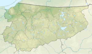
The ridge is located in the Warmia-Masurian Voivodeship on the southwestern border of the former East Prussia . It was formed as a moraine in the cold ages and is a southern part of the Baltic Ridge . The Kernsdorf Heights are part of the historical landscape of the Oberland on the geographical border with the Masurian Lake District and are located about halfway between Gdansk and Warsaw , around 40 km (as the crow flies ) southwest of Olsztyn ( Allenstein ). Its highest mountain is the highest elevation in East Prussia and the second highest elevation in northern Poland. There is a radio tower on top and a hotel nearby. The Kernsdorf Heights have been part of the Krajobrazowy Wzgórz Dylewskich landscape park since 1994 .
The localities that lie directly in or on the Kernsdorfer Höhe include Lubawa ( Löbau ) and Stębark ( Tannenberg ).
Winter sports
The Kernsdorfer Heights, with their good snow conditions, were already considered an ideal winter sports area in the past, with steep valley runs in some places. Today there is a ski lift there that can be used not only for alpine skiers , but also with a toboggan .
See also
- Turmberg - highest point in northern Poland, Pomeranian Lake District
- Seesker Höhe - third highest point in northern Poland, Masurian Lake District
Individual evidence
- ^ Gerd Hardenberg - Travel Guide East Prussia - Southern Part -, page 119, Verlag Gerhard Rautenberg 1995
- ↑ Internet presence of the Ermland -Masuren Journal
- ↑ See: Werner Buxa: Bilder aus Ostpreußen, Augsburg 1990, p. 168.
- ↑ Internet presence of the Ermland -Masuren Journal

