Ebberg (Bielefeld)
| Ebberg | ||
|---|---|---|
|
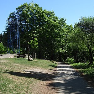
Iron Anton and Hermannsweg on the summit of the Ebberg |
||
| height | 309.1 m above sea level NHN | |
| location | North Rhine-Westphalia , Germany | |
| Mountains | Teutoburg Forest | |
| Coordinates | 51 ° 58 '44 " N , 8 ° 34' 59" E | |
|
|
||
| particularities | Bismarck Tower ( AT ) | |
The Ebberg is 309.1 m above sea level. NHN high mountain in the southeast of Bielefeld . It belongs to the main ridge of the Teutoburg Forest , which in this area forms the border between the Bielefeld districts of Senne and Stieghorst . The Hermannsweg runs over the summit and on the summit stands the Bielefeld Bismarck Tower , called Eiserne Anton , which was built in 1895 and renovated in 2004; about 200 m further east a 21 m high radio tower of a British army; from there a municipal pumping station approx. 300 m to the east .

